Subtropical Storm Theta forms, breaking record for most named storms in a season
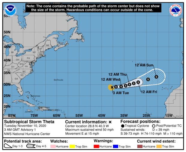
The Atlantic Basin hurricane season is now in uncharted territory. Subtropical Storm Theta formed Monday night in the open waters of the Atlantic Ocean, breaking the record for most named storms in a single season.
While Theta is no threat to land, it marks a milestone. This is storm number 29 for 2020, breaking the record of 28 tropical storms set in the memorable season of 2005, a season which included Hurricanes Katrina and Wilma. As an illustration of how remarkably active 2005 and now 2020 are, the most active season prior was 20 storms back in 1933.
As of Monday night, Theta was located in the middle of nowhere, about 1000 miles southwest of the Azores, with winds of 50 mph. The storm is heading east, away from the U.S. and towards Europe.
This is just another record to add to an ever-growing list in a season which has defied what many meteorologists thought was possible. So far in 2020, the U.S. has seen 12 landfalling tropical systems, including Eta which hit South Florida this morning, shattering the old record of 9.
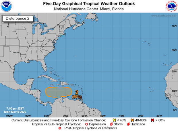
And the season is not over yet. The National Hurricane Center is also monitoring another tropical wave in the Caribbean, which now has a medium chance of development as it moves west towards Central America.
So, why has 2020 been so active? There's no one answer. Just about everything that needed to line up for a banner season, did.
The African Monsoon was very active this summer, which generated more tropical seedlings than normal. Pressures over the Tropical Atlantic were lower than normal, producing an environment conducive for development. And the lack of El Niño and the late season development of La Niña also played a role.
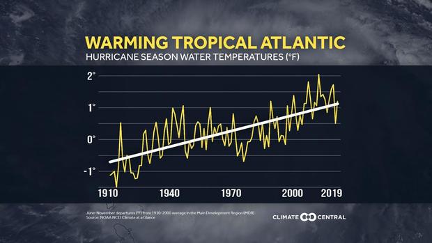
But what really stood out this year has been the exceptionally warm Atlantic Ocean waters. Just about the entire Atlantic Basin was above normal this season. This is not a coincidence. Increasingly, ocean waters are more frequently above normal, mainly due to human-caused climate change.
Since 1900, Tropical Atlantic sea surface temperatures have increased by 2 degrees Fahrenheit as a result of the build up of heat-trapping greenhouse pollution from the burning of fossil fuels. The oceans store 90% of the excess heat trapped by our atmosphere. This excess heat acts as high octane fuel for tropical storms and hurricanes.
In fact, 2020 has seen one of the highest numbers of systems that rapidly intensified, defined by a storm's winds increasing at least 35 mph in 24 hours. Remarkably, the last five systems in a row — Delta, Epsilon, Zeta and Eta — all experienced rapid intensification. This would be an extraordinary feat for any time of year, let alone so late in the season.
With at least a few weeks left before waters cool down below thresholds for tropical systems to form, it is highly likely 2020 will continue to overachieve, spawning even more systems.
