"Historic" flooding possible when Hurricane Sally hits Gulf Coast
A plodding but powerful Hurricane Sally was creeping toward the Gulf Coast early Tuesday, with forecasters warning of potentially "historic" flooding from "deadly storm surges" and "extreme life threatening flash flooding" spurred by up to 2-and-a-half feet of rain in some places — as well as the possibility of tornadoes. The threats of dramatically heavy rainfall and storm surges as high as nine feet were exacerbated by the storm's slow movement.
More than 17 million people were in Sally's path. Hundreds of miles of coastline are under storm watches and warnings. The warnings stretched from east of the mouth of the Pearl River to Navarre, Florida.
Sally reached hurricane strength Monday and quickly intensified to a Category 2 storm with 100 mph winds but then weakened somewhat.
At 5 a.m. EDT, the storm had sustained winds of 85 mph, a Category 1. But the National Hurricane Center said, "Some re-strengthening is forecast early to occur later today, and Sally is expected to be a dangerous hurricane when it moves onshore along the north-central Gulf coast."
CBS News weather producer David Parkinson said the storm "will make landfall on Wednesday in the late morning/early afternoon as a Category 1."
Sally was some 60 miles east-southeast of the mouth of the Mississippi River and 115 miles south-southeast of Biloxi, Mississippi, barely moving west-northwest at a measly 2 mph.
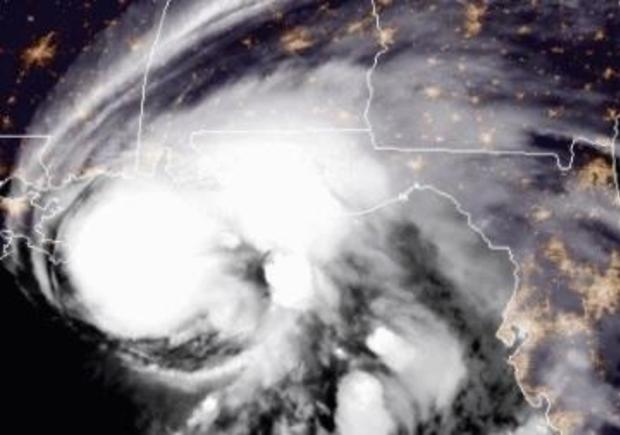
The hurricane center said, "On the forecast track, the center of Sally will move near the coast of southeastern Louisiana later today, and make landfall in the hurricane warning area tonight or Wednesday morning."
Florida Gov. Ron DeSantis declared an emergency in the Panhandle's westernmost counties, which were being pummeled by rain from Sally's outer bands early Tuesday.
President Trump issued emergency declarations for parts of Louisiana, Mississippi and Alabama on Monday, and on Twitter urged residents to listen to state and local leaders.
Alabama Gov. Kay Ivey sought the presidential declaration after the National Weather Service in Mobile, Alabama, warned of the increasing likelihood of "dangerous and potentially historic flooding," with waters rising as much as 9 feet above ground in parts of the Mobile metro area.
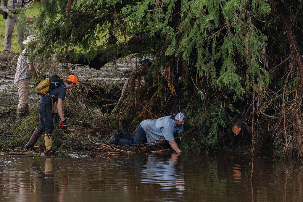
Flood control authorities in Louisiana remained on guard, closing gates along networks of waterways that could be pushed over their banks by the possible surge from the Gulf.
The southwestern part of the state was pummeled by Hurricane Laura on Aug. 27 and an estimated 2,000 evacuees from that storm were sheltered in New Orleans, mostly in hotels.
It all seemed a distant threat Monday afternoon in Waveland, Mississippi, as a shirtless, barefooted Trevor Claunch, of nearby Bay St. Louis, got in some last-minute beach time. But there were signs of trouble coming. Claunch marveled at how the Gulf waters had already crept over swaths of sandy shore and infiltrated bike paths and parking lots.
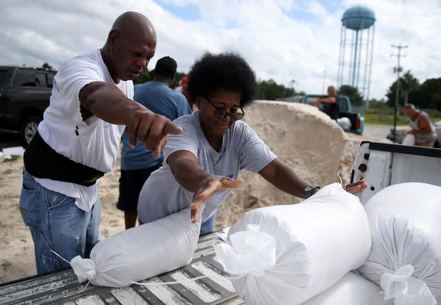
Others were taking the storm seriously as well, despite sunny skies. Coastal casinos shut down under orders from the Mississippi Gaming Commission. All the casinos are either on or near the water. Meanwhile, motorists filled a convenience store parking lot in Ocean Springs, Mississippi, as they topped off gas tanks and stocked up on ice, beer and snacks.
Monday marked only the second time on record, forecasters said, that five tropical cyclones swirled simultaneously in the Atlantic basin. The last time that happened was in 1971. None of the others were expected to threaten the U.S. this week, if at all, and one was downgraded to a low pressure trough Monday evening.
The extraordinarily busy hurricane season - like the catastrophic wildfire season on the West Coast - has focused attention on the role of climate change.
Scientists say global warming is making the strongest of hurricanes, those with wind speeds of 110 mph or more, even stronger. Also, warmer air holds more moisture, making storms rainier, and rising seas from global warming make storm surges higher and more damaging.
In addition, scientists have been seeing tropical storms and hurricanes slow down once they hit the United States by about 17% since 1900, and that gives them the opportunity to unload more rain over one place, as 2017's Hurricane Harvey did in Houston.