Francine lashes Louisiana, leaves hundreds of thousands without power
Francine weakened into a post-tropical cyclone Thursday afternoon as it moved north across Mississippi, soaking that state and its neighbors in heavy rain after it slammed into the Louisiana coast Wednesday evening as a dangerous Category 2 hurricane. It was tracking over central Mississippi by the early evening.
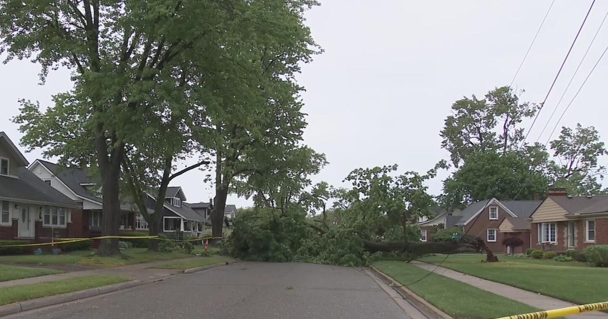
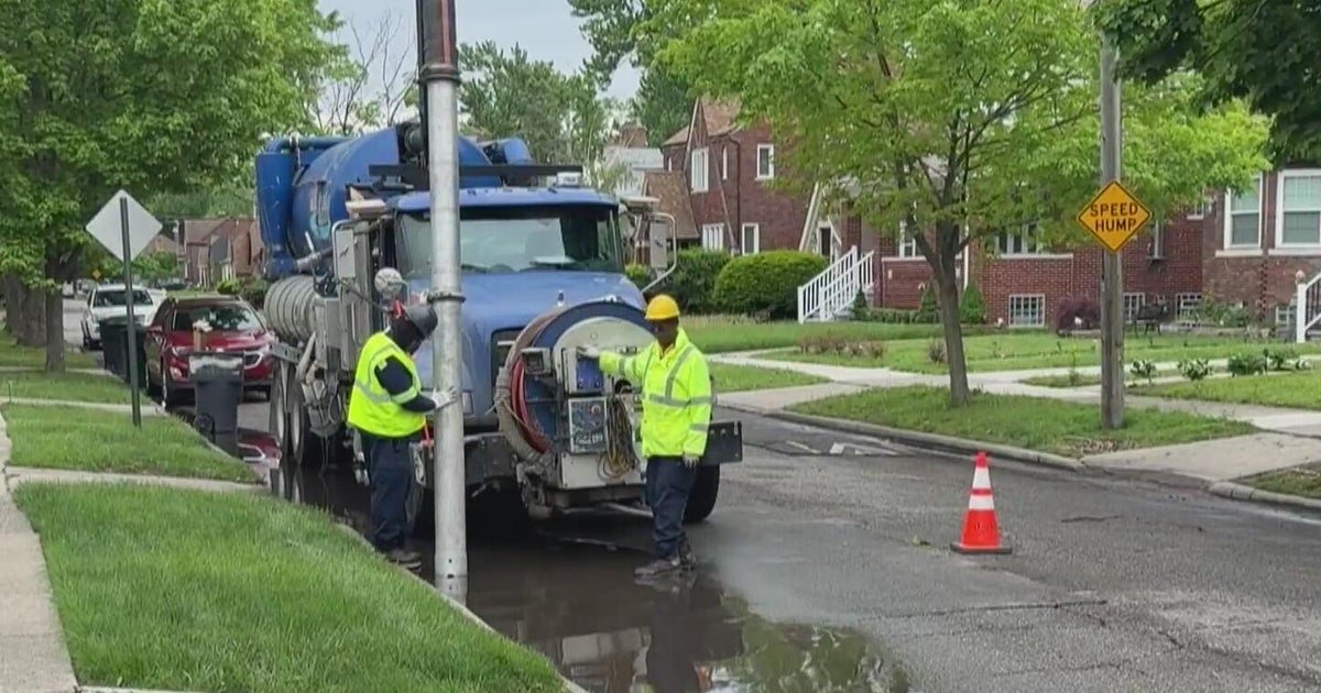
As the system moved inland, crews began clearing roads and restoring electricity while neighborhoods and businesses started cleaning up the mess. There were no immediate reports of deaths or injuries, Louisiana Gov. Jeff Landry said.
"The human spirit is defined by its resiliency, and resiliency is what defines Louisiana," Landry said in a news conference Thursday. "Certainly there are times and situations that try us, but it is also when we in this state are at our very best."
At one point, around 500 people were in emergency shelters, state officials said.
"The amount of money invested in resilience has really made a difference, from the power outages to the number of homes saved," said Deanne Criswell, the administrator of the Federal Emergency Management Agency, who attended the governor's news conference.
New Orleans was inundated with 7.33 inches of rain Wednesday, about three times the amount of rain, 2.33 inches, it receives on average in September, according to the National Weather Service.
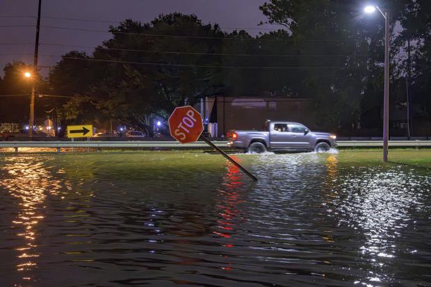
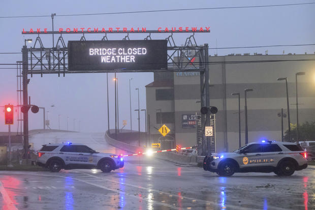
The storm knocked out electricity to hundreds of thousands of homes and businesses and threatened widespread flooding as it sent a potentially deadly storm surge rushing inland along the Gulf Coast. But Francine quickly lost much of its punch as it moved over land, and it was initially downgraded to a tropical storm late Wednesday night.
More than 149,000 customers were without power across Louisiana late Thursday night according to utility tracker PowerOutage.us, down from a peak of more than 450,000, according to the Public Service Commission.
Francine continued to weaken Thursday, with maximum sustained winds dropping to 30 mph as of 11 p.m. EDT, according to the National Hurricane Center. It was centered about 50 miles west of Memphis, Tennessee, moving north at 6 mph, but was expected to shift to a northwest track and continue to slow down. It was forecast to dissipate Friday.
The National Hurricane Center said Francine would continue bringing the threat of heavy rainfall and tornadoes to portions of the Mississippi Delta, Alabama, western Georgia and the Florida Panhandle.
"Little change in strength is forecast during the next 24 hours," the hurricane center said.
A federal jury in Memphis was sent home early in the trial of three former police officers charged with civil rights violations in the beating death of Tyre Nichols. U.S. District Judge Mark Norris blamed the remnants of Francine, saying he wanted to spare jurors from worrying about the weather and getting distracted.
The storm drenched the northern Gulf Coast. Up to 6 inches of rain was possible in parts of Mississippi, Arkansas, Tennessee and Georgia, with up to 10 inches possible in parts of Alabama and Florida. Flash flooding threatened cities as far away as Jackson, Mississippi; Birmingham, Alabama; Memphis, Tennessee; and Atlanta.
On Wednesday evening, Francine crashed ashore in Terrebonne Parish, about 30 miles southwest of Morgan City, Louisiana. Packing maximum sustained winds near 100 mph, the storm then battered a fragile coastal region that hasn't fully recovered from a series of devastating hurricanes in 2020 and 2021.
Morgan City Fire Chief Alvin Cockerham said Francine quickly flooded streets, snapped power lines and sent tree limbs crashing down.
"It's a little bit worse than what I expected to be honest with you," Cockerham said of the onslaught. "I pulled all my trucks back to the station; it's too dangerous to be out there in this."
The city of Thibodaux, located about 30 miles east of Morgan City, saw seven inches of rain in 24 hours, according to the National Weather Service.
Right in the heart of Terrebonne Parish, Dan and Samantha Stevens lost their passion project of a thrift store when the storm came through the aisles, tore down walls and destroyed its roof.
"There's some really good people in this neighborhood," Samantha Stevens told CBS News. "A lot of them are less fortunate, and they look forward to coming here, it's their favorite place."
Dan Stevens said that despite the damage, he remains grateful.
"I've been blessed my whole life," Dan Stevens told CBS News. "So this is the one bad thing happens to me, I'm good man. Doesn't bother me, you know it really doesn't."
During the raging storm, Ascension Parish Sheriff's deputies in the city of Donaldsonville rescued a woman pinned under a fallen tree using chainsaws and jacks to lift her to safety.
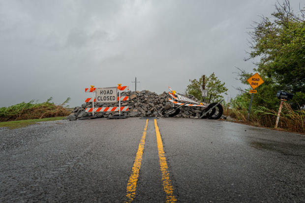
News footage from coastal communities showed waves from lakes, rivers and Gulf waters thrashing seawalls. Water poured into city streets in blinding downpours. Oak and cypress trees leaned in the high winds, and some utility poles swayed.
By early Thursday, water was receding from flooded streets in Jefferson Parish, but canals were still high, parish President Cynthia Lee Sheng said in a social media post. Pumps that operated through the night could not keep up with the storm, causing sewer system problems, she said.
She asked residents to give the parish time to clear the streets, noting that the hazards after a storm can sometimes be more dangerous than the storm itself.
As the sun rose in Morgan City, residents gathered tree branches that were strewn across their yards, where water rose almost to their doors. Pamela Miller, 54, stepped outside to survey the damage after a large tree fell on the roof of her home.
"It was a really loud noise, a jolt, and that's when we realized the tree had come down," she told the Associated Press. "Luckily it did not go through the roof."
Jeffrey Beadle, 67, emerged from the hotel room where he sheltered for the night.
Beadle left his home in low-lying Bayou Louis, about 10 miles outside town, on Wednesday as the rain picked up. He lived there for 30 years without any major damage, but he was worried this time would be different because his home was right in the hurricane's path. He loaded his car in preparation to check on his home.
"There's nobody over on that end I can call," he told the AP, explaining that he did not know what he would find. "Hope everything's good."
Hardest hit by the blackouts was Terrebonne Parish near where the storm's center hit land, as well as neighboring St. Mary Parish, which includes Morgan City.
Det. Lt. David Spencer, a spokesperson for the St. Mary Parish Sheriff's Office, told CBS News in an email Wednesday night that the parish was "seeing more flooding than originally predicted."
Spencer said the area was experiencing downed trees and power lines and damage to homes.
"We have had some roofs severely damaged and even gone," Spencer wrote, adding that there were no reports of injuries.
Sheltering at her mother's home just outside Morgan City, Laura Leftwich said blasts of wind had swept away two large birdhouses outside. She had a generator powering an internet connection so she could video chat with friends, holding her computer to a window to show them water overflowing in the street.
If the storm had been any more intense, "I wouldn't have the guts to look outside," said Leftwich, 40. "It's a little scary."
Terrebonne Parish President Jason Bergeron had told CBS News on Wednesday that levies were holding but the water was rising.
"The ground is saturated with water, and as the levy system is closed that water has a harder time getting out, except for some areas that have some pumps," Bergeron said.
Francine drew fuel from exceedingly warm Gulf of Mexico waters, strengthening to a Category 2 storm hours before landfall, the National Hurricane Center said. Category 2 hurricanes are classified as having winds of between 96 to 110 mph that are capable of extensive damage.
Landry said the National Guard would fan out to parishes impacted by Francine. They have food, water, nearly 400 high-water vehicles, about 100 boats and 50 helicopters to respond to the storm, including for possible search-and-rescue operations.
Louisianans have experience with hurricanes
Since the mid-19th century, some 57 hurricanes have tracked over or made landfall in Louisiana, according to The Weather Channel. Among them are some of the strongest, costliest and deadliest storms in U.S. history.
Morgan City, home to around 11,500 people, sits on the banks of the Atchafalaya River in south Louisiana and is surrounded by lakes and marsh. It's described on the city's website as "gateway to the Gulf of Mexico for the shrimping and oilfield industries."
Luis Morfin, 26, left his RV camper outside Morgan City's levee to hunker down at a friend's home Wednesday night. Winds lashed the windows as they watching a TV powered by a generator. The power was out, but they were prepared to cook with steaks and potatoes on a propane stove.
"We knew what we were expecting," Morfin said. "I don't know how good my camper is, but we'll figure that out tomorrow."
President Biden granted an emergency declaration to help Louisiana secure expedited federal money and assistance. Landry and Mississippi Gov. Tate Reeves also declared states of emergency.