New England fears a hurricane as Henri approaches
It's been 30 years since a hurricane made direct landfall in New England — but there's a chance that streak will end later this week.
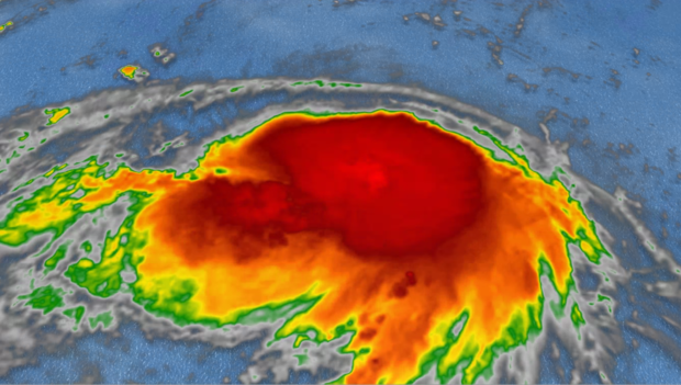
Tropical Storm Henri is the 8th named system of what has already been an active 2021 season. Right now, the storm is not threatening anyone — it's spinning far offshore of the East Coast, about 800 miles south of Nantucket, with tropical storm force winds. But Friday afternoon, the National Hurricane Center tweeted the storm is almost a hurricane and upgraded a hurricane watch to a hurricane warning for parts of Long Island and Connecticut. Hurricane conditions, including storm surges, are also possible in parts of Massachusetts and Rhode Island on Sunday.
Following the forecast updates, Rhode Island Governor Dan McKee declared a disaster emergency for the state "due to the dangers of life and property posed by this storm." The order allows the state to begin disaster preparation and acquire additional resources ahead of the storm's potential landfall.
Governor Ned Lamont, of neighboring Connecticut, has also declared a state of emergency. "Right now, it's a good idea for everyone to be prepared and expect to shelter in place by Sunday afternoon through at least Monday morning," he said. "We'll continue to monitor the storm's progress and will provide updates as necessary."
Over the next several days, the system is expected to strengthen and move closer to the Eastern Seaboard. It's expected to pass safely east of the middle Atlantic, but may slam into eastern New England as a landfalling hurricane. The last time this happened was Hurricane Bob in 1991, which came ashore with 100 mph winds.
Much of the storm's future is not yet known, but it's advised that anyone exposed — especially those close to the coast of southeast New England — should start making initial preparations, like putting together a plan and hurricane safety kit.
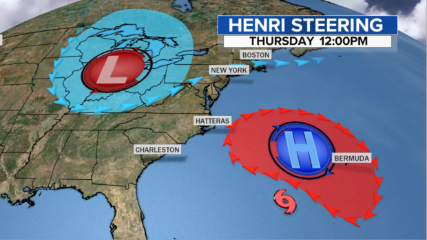
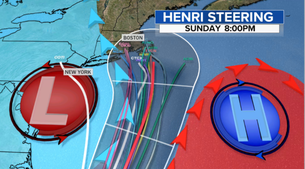
Right now, the storm is being steered westward by a high pressure system near Bermuda.
It is fighting off strong winds in the upper atmosphere — called wind shear — so the overall structure is relatively disorganized. That's why Henri has been gaining strength rather slowly. But on Friday, the wind shear is expected to dissipate, which will allow Henri to intensify.
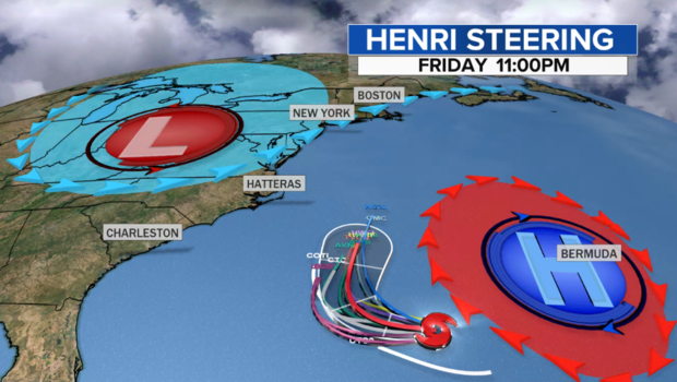
The storm will also begin to turn north in response to a corridor opening up between eastward-moving high pressure over Bermuda moving and a weak upper level storm over the Ohio Valley. These two features will propel Henri over the warm waters of the Gulf Stream.
The lines on the below graphic represent the various computer model forecast tracks, and the cone represents the National Hurricane Center Track:
As the system continues to move north, the official forecast from the National Hurricane Center brings the intensity up to just shy of a Category 2 hurricane, with max winds of 90 mph late Saturday. The computer models forecast a similar intensity.
As Henri moves north, it will stir up the surf and cause a very high rip current risk along a large part of the Eastern Seaboard this weekend. It will likely move from the Carolinas to the Mid-Atlantic, and eventually into New England.
What happens after that makes all the difference between a direct hit on New England and a glancing blow. The difference hinges on low pressure moving eastward from the Ohio Valley into the Northeast.
There's general agreement in the models that the circulation around low pressure will capture Henri, dragging it slightly further west than it otherwise would have gone. But the question is, how far west? That detail is still unclear and will be ironed out as the storm gets closer to the coast over the next day or two. But with over half of the computer models directing the storm directly into Southeast New England, it is early enough to raise the red flags.
Currently, the places most at risk are the extreme eastern areas like Martha's Vineyard, Nantucket and Cape Cod. Still, a lot can and will change between now and then. And it should be noted there are at least a couple of solutions that take the storm even further west towards Long Island and at least a few that keep the center of the storm out to sea.
There's another piece of uncertainty: Will the storm slow and weaken before any potential landfall?
Indications have shown that Henri may slow down some as it gets close to the New England coast. If that happens, it would give the storm just enough time to weaken below hurricane strength. That's because ocean temperatures drop from 80 degrees off the Del Marva Peninsula to around 70 degrees south of Cape Cod, meaning less energy is available to feed the system.
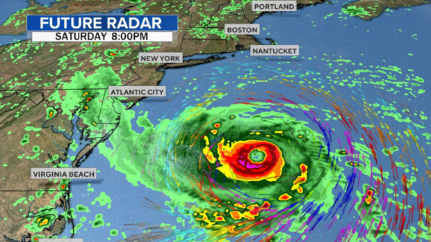
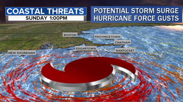
Still, the real possibility exists that Henri will make landfall as a hurricane or very strong tropical storm sometime Sunday. If that occurs. expect significant coastal flooding from storm surge, lashing winds gusting to hurricane force and tropical downpours.
