This year's Atlantic hurricane season could break pattern
MIAMI -- U.S. government forecasters expect a near-normal Atlantic hurricane season, after three relatively slow years. But they also say climate conditions that influence storm development are making it difficult to predict how many hurricanes and tropical storms will arise over the next six months.
The National Oceanic and Atmospheric Administration's outlook Friday called for a near-normal season with 10 to 16 named storms, with four to eight hurricanes and one to four "major" ones with winds reaching 111 mph and up.
The long-term season averages are 12 named storms, with six hurricanes and three major ones.
The Atlantic hurricane season officially starts June 1, but tropical weather got a head-start this year: Hurricane Alex made an unseasonable debut in January over the far eastern Atlantic.
The National Hurricane Center says an area of low pressure between Bermuda and the Bahamas had a high chance of brewing into something bigger Friday or Saturday.
Hurricane hunter aircraft will investigate the disturbance Friday, and communities along the coasts of Georgia and the Carolinas should monitor its development, said NOAA Administrator Kathryn Sullivan.
Forecast challenges
While they can't predict whether any storm will strike the U.S., and more tropical storms are expected than in the last three years, NOAA officials said significant variables are at play.
It's unclear whether a decades-long high-activity era for Atlantic hurricanes has ended, said Gerry Bell, lead seasonal hurricane forecaster with NOAA's Climate Prediction Center. Meanwhile, El Nino is dissipating while La Nina looms for the season's peak from August through October.
El Nino is the natural warming of parts of the Pacific Ocean that changes weather worldwide. That tends to reduce hurricane activity in the Atlantic, while La Nina tends to increase it.
The active storm era associated with warm Atlantic temperatures and stronger West African monsoons began in 1995, but recent hurricane seasons showed shifts toward a cooler phase marked by colder waters and a weaker monsoon, Bell said.
Each era can last 25 to 40 years, and it might take years to determine whether the transition has happened, Bell said.
The last transition to a less active hurricane era happened in the 1970s, without the data and computer models that forecasters have now. "We're watching it for the first time with very new eyes," Sullivan said.
2015 storm tally
The 2015 season was slightly below average with 11 named storms, including two tropical storms that made landfall and caused flooding in South Carolina and Texas.
Hurricane Joaquin, one of two storms to reach major hurricane strength, killed all 33 mariners aboard a cargo ship that sank off the Bahamas in October.
During U.S. Coast Guard investigative hearings this month into the sinking of the El Faro, one federal investigator characterized the disaster as "a colossal failure" of management.
Initial forecasts for Joaquin also were wildly inaccurate. Sullivan said NOAA is on track to meet storm track and intensity forecast improvement goals, and a new weather satellite launching this fall will produce much sharper images of hurricanes and other severe weather.
Coastal risks
The last major hurricane to strike the U.S. mainland was Hurricane Wilma, which cut across Florida in 2005. Wind speeds, not damage estimates, determine whether a hurricane is classified as "major" - that's Category 3 and up on the hurricane wind scale.
Since 2005, the population in the 185 coastline counties most threatened by hurricanes has grown 8.7 percent to 59.2 million people, according to U.S. Census estimates. Overall, 143.6 million people - 44.7 percent of the U.S. population - from Maine to Texas could be living in harm's way.
Other Census figures hint at the potential financial risks throughout those states: 60.1 million housing units and 3.3 million business establishments with 52.3 million paid workers.
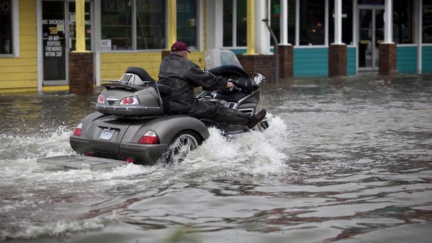
Ferocious storm winds aren't the deadliest threat. According to the National Hurricane Center in Miami, storm surge and rainfall flooding combine for three-quarters of all U.S. deaths from hurricanes, tropical storms or tropical depressions.
Major damage
In the Bahamas, Joaquin caused over $60 million in damage, according to the hurricane center. The islands reported widespread flooding that contaminated drinking water, cut off an airport and swamped a local fishing fleet.
Even "minor" storms can leave misery behind. After Tropical Storm Erika swept through the Caribbean last year, damage estimates on the island of Dominica ranged up to $500 million for homes, roads, bridges and infrastructure, and Puerto Rico reported $17.4 million in agricultural losses for plantains, bananas and coffee.
The Northeast was wracked by catastrophic flooding, first from Hurricane Irene in 2011 and again from Superstorm Sandy in 2012. Damage estimates tallied in the tens of billions of dollars.
Due to the financial hardships left in Sandy's wake, the Federal Emergency Management Agency said Monday that it's overhauling its appeals process for flood insurance claims with more transparency and oversight. Homeowners will be able to take disputes directly to FEMA instead of first going through the insurance companies they're fighting.
Climate change
Rising sea levels are expected to increase the vulnerability of coastal communities to flooding from tropical systems.
Recent research indicates climate change is likely to make hurricanes more intense in the future.
Improved computer models show that warming atmospheric conditions may hinder tropical cyclone development worldwide, says David Nolan, a University of Miami professor of atmospheric sciences.
But the hurricanes that do form could grow more intense because ocean temperatures will be higher, Nolan says. Warm ocean waters feed hurricanes like fuel in an engine.
"The ones that do occur could be a little bit stronger," Nolan says, "but the changes over the next 10, 20, 30 years would be very small, almost undetectable."

