September the warmest on record for Twin Cities, second wettest for Duluth

MINNEAPOLIS — After a dry start to the month, September is ending much wetter and warmer than usual for many Minnesotans.
Minneapolis-St. Paul International Airport has observed rain on eight of the last nine days of September adding up to 5.08" over that stretch. Totals at MSP for the entire month sit at 5.72", more than the average of 3.02". In Duluth, 10.36" of rain has fallen, making it the second wettest September on record behind 1881 when 11.52" of rain fell.
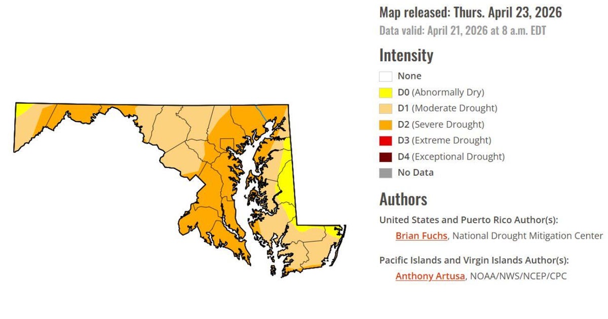
Though the rain has been substantial, it hasn't been enough to completely cure the ongoing drought. According to the U.S. Drought Monitor on Sept. 28, 47% of Minnesota's coverage area is still in severe drought or worse. That is down from 64% in the Sept. 19 report.

As for temperatures, September was warm for everyone with all locations coming in 3-6° above average (highs and lows averaged together over the entire month).

At MSP, nearly two-thirds of the month was warmer than normal with an average temperature through Sept. 29 of 68.8°. With highs in the 80s Saturday, September 2023 is now the warmest on record for the Twin Cities with an average of 69.1°. The previous record is 68.8° (Sept. 1897).

According to the Climate Prediction Center, the warmth is expected to linger into October across the Upper Midwest. They say there's an 80% chance of near or above normal temperatures through the month. When it comes to precipitation, it's a toss-up with equal chances for an above or below average month.