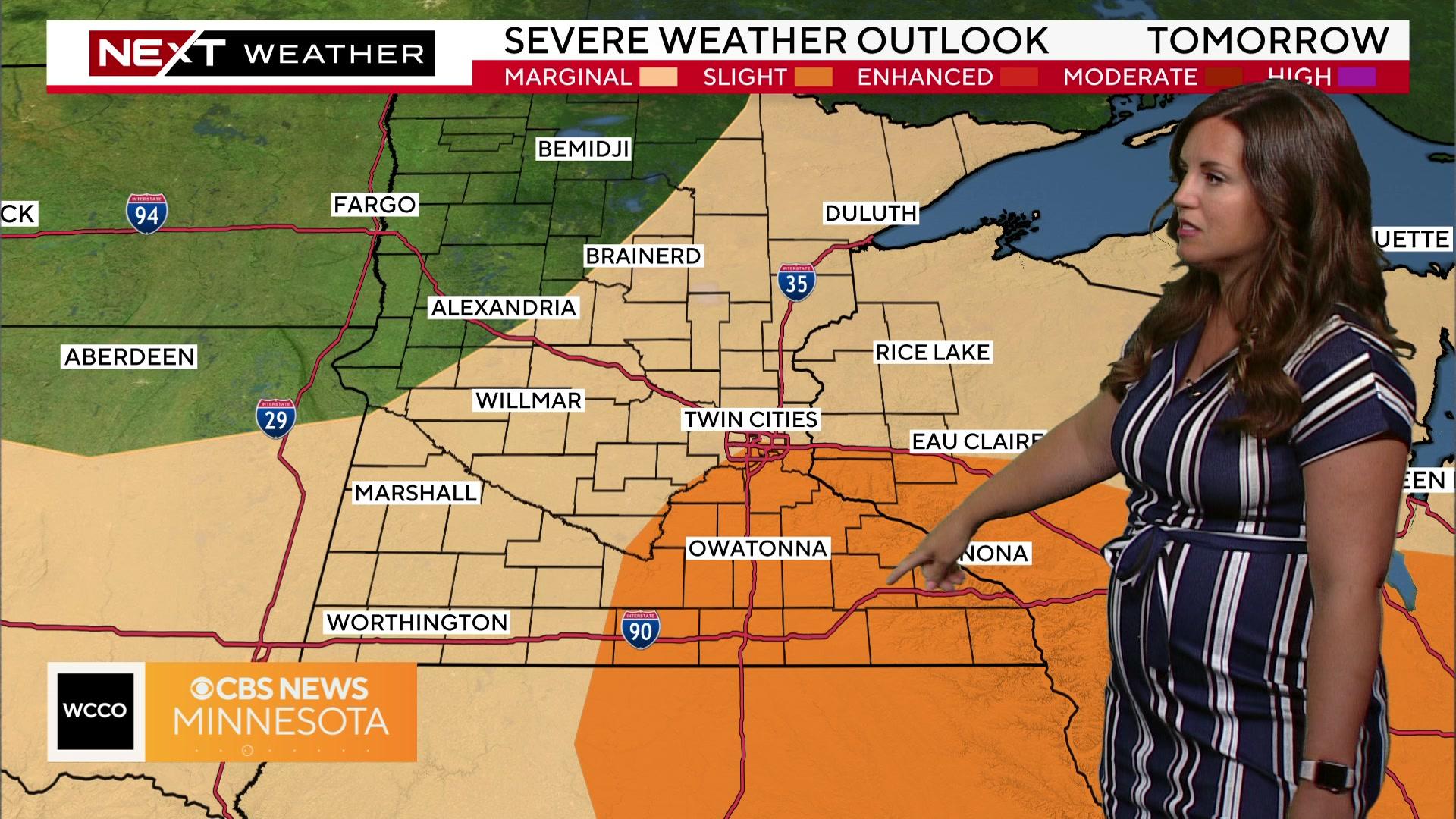
More chances for severe storms in Minnesota loom going into Monday


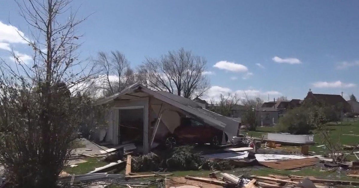
MINNEAPOLIS — Parts of Minnesota are still assessing damage after storms late Saturday and overnight left some with large hail, and others with high winds that knocked down trees and led to power outages for tens of thousands.
And we may not be finished with the severe storms just yet. WCCO meteorologist Katie Steiner says that there's another chance for storms today, and Monday brings with it a marginal to slight risk of severe weather.
Steiner says one silver lining is that the National Weather Service canceled the heat advisory for the Twin Cities. High temperatures could still flirt with 90 degrees, but it's not looking to be quite as hot as anticipated.
The National Weather Service Twin Cities says it hit 90 degrees at MSP Airport for the first time this year on Sunday. It is the latest it has reached 90 degrees since 1993.
Steiner says we have a chance for storms Sunday, most likely coming in the evening to overnight hours, with the best chance for storms looking to be in the southern part of the state.
Storms will come out of the Dakotas into western Minnesota after midnight, WCCO meteorologist Lisa Meadows says. The main concern with that line of storms is damaging winds. Storms are expected to weaken as the head into central Minnesota and the Twin Cities metro in the early morning.
Monday should set up similarly to Saturday, though perhaps not as balmy. It should be warm, with temperatures in the upper 80s.
Following that, expect a lovely stretch of dry, cooler weather that will be very comfortable.