Despite the late season cold snap, it's still a tame winter for the Twin Cities

Minnesotans are thawing out from the recent cold snap that brought temperatures of double digits below zero and even more frigid wind chills.
Temps in the Twin Cities have been below average for the majority of February.
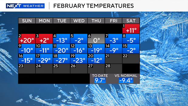
The average number of days in February that are less than 10 degrees is two. So far, the Twin Cities has endured six such days.
The record for most days in February with temps less than 10 degrees was set in 1936 with 19.
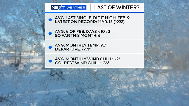
The coldest wind chill so far in February is minus 36 degrees, and the monthly average is minus 2 degrees.
Despite the chilly February cold, this winter in the Twin Cities is still tracking to be fairly average compared to past winters.
The Minnesota Department of Natural Resources compares winters using the Twin Cities Snow and Cold Index. The method assigns points for daily high temperatures of 10 degrees and colder, low temperatures of minus 20 degrees or colder and daily snowfall rates of one inch or more.
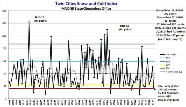
As of Feb. 21, 2025, this winter has 37 points — 31 points for cold and six points for snow.
Last winter accumulated 41 points — 11 points for cold and 30 points for snow — and the winter of 2022 - 2023 had 126 points.
Looking forward to the spring, the National Oceanic and Atmospheric Administration is predicting Minnesota will see near-normal temperatures. The majority of the country, however, may see warmer-than-average temperatures.