This fall was warmest on record for Twin Cities
MINNEAPOLIS — Sunday was the first day of meteorological winter. Meteorological fall is September, October and November. This is how weather record keeping is done to make it easier on record calculations.
Despite this recent cold snap, the Twin Cities still ended up with the warmest fall on record.
The metro had a big deficit in snowfall last month with only 0.9 inches of snow, making the month almost 6 inches below average.
That was not the case for rain though, as the metro ended up with almost 2 inches of precipitation, bringing the month above average by 0.33 inches.
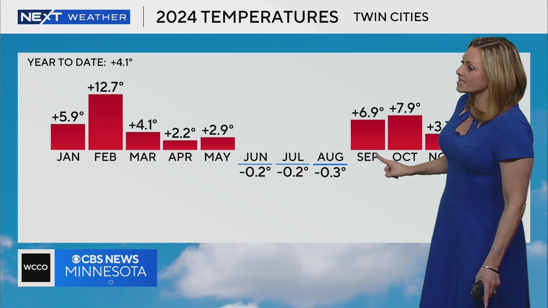
Temperatures were wildly warm in November as the metro only had one week of below-average highs all month, ending up 3.7 degrees above average.
The fall average temperature wrapped up at 55.4 degrees, which makes it the warmest on record for the metro — beating out the 1931 average by almost a full degree.
Another interesting note is that 2016, 2015, 2023 and 2021 all made it in the top six.
Other climate sites like St. Cloud ended with the third warmest fall on record and Eau Claire came in with its fourth warmest.
The metro's monthly temperatures this year were all above average except for the summer months, which were all slightly below average. So far, the metro is running about 4 degrees above average temperature-wise this year.
La Niña is forecasted to impact the region this winter, leaving Minnesota with an outlook at this time trending wetter than average for the eastern part of the state and Wisconsin, and cooler than average west of the metro.


