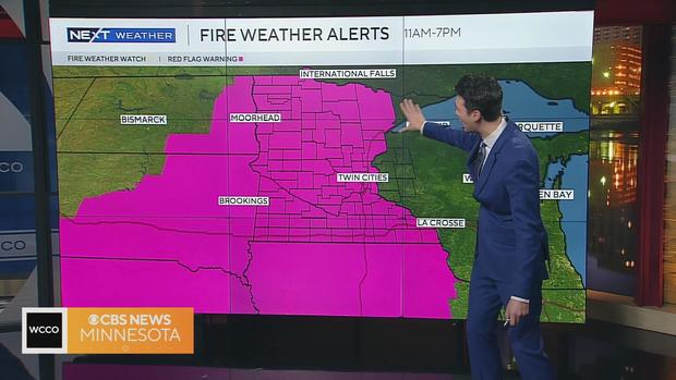
Red flag warning issued for most of Minnesota due to strong gusts, dry conditions

MINNEAPOLIS — Nearly all areas of Minnesota are under a red flag warning Thursday due to extreme fire risk.
The National Weather Service says there are three main areas with warnings:
- 8 a.m. to 7 p.m. in northwestern Minnesota including the following counties: Becker, Beltrami, Clay, Clearwater, Grant, Hubbard, Kittson, Lake Of The Woods, Mahnomen, Marshall, Norman, Otter Tail, Pennington, Polk, Red Lake, Roseau, Wadena and Wilkin.
- 11 a.m. to 7 p.m. in central and southern Minnesota: Anoka, Benton, Big Stone, Blue Earth, Brown, Carver, Chippewa, Chisago, Cottonwood, Dakota, Dodge, Douglas, Faribault, Fillmore, Freeborn, Goodhue, Hennepin, Houston, Isanti, Jackson, Kanabec, Kandiyohi, Lac Qui Parle, Le Sueur, Lincoln, Lyon, Martin, McLeod, Meeker, Mille Lacs, Morrison, Mower, Murray, Nicollet, Nobles, Olmsted, Pipestone, Pope, Ramsey, Redwood, Renville, Rice, Rock, Scott, Sherburne, Sibley, Stearns, Steele, Stevens, Swift, Todd, Traverse, Wabasha, Waseca, Washington, Watonwan, Winona, Wright and Yellow Medicine counties.
- 12 a.m. to 7 p.m. in areas of northeastern Minnesota: Aitkin, Carlton, Cass, Crow Wing, Itasca, Koochiching, Pine and St. Louis counties.
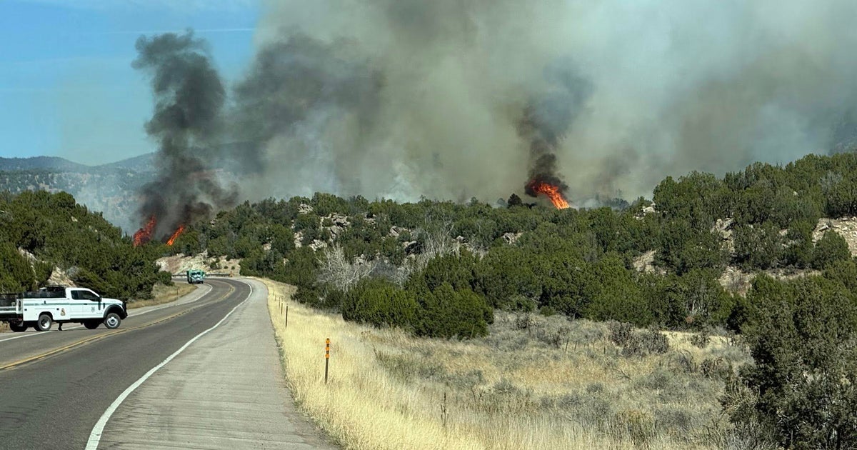
Gusty winds and the ongoing dry weather mean fires can spread quickly and spiral out of control. Residents should not burn anything in counties where the warning is in effect.
"Embers can be carried for over a mile in high winds like this. People should use extreme caution until conditions improve," said Karen Harrison, DNR wildfire prevention specialist.
Gusts will reach around 35 to 45 mph on Thursday bringing high temperatures near 70 degrees.
"For the entire state to be under the same conditions at the same time that's really what's concerning," said Mike Warnke, DNR Forestry Wildfire Administration. "As soon as the fire gets going today it is going to take a matter of minutes before it grows very big to the point of acres an hour."
He said coordination began with multiple agencies early Thursday morning to ensure crews were in place to support communities if a fire spreads.
Thursday afternoon, a fire destroyed three downtown businesses in Rice Lake, Wisconsin.
Another fire spread quickly in Carver County, jumping from a building and leaving several cars charred.
Warnke wants folks to know this before sparking a flame.
"In the event you have a fire and allow it to escape and it gets away from, you'll be liable for any suppression damage you cause," he said.
The DNR says even a less-than-half-acre fire can set you back about $500, with a large fire costing thousands of dollars.