NEXT Weather: Warmest New Year's Eve in over a decade
MINNEAPOLIS – More snow and cold are coming, but it's not sticking around for long.
A long and narrow band of light snow entered the northwest corner of Minnesota Thursday, reaching the Twin Cities in the late evening. As it exited the state overnight, some slick surfaces may remain for Friday morning commuters.
Temperatures will drop into the low-20s Friday, which is just a few degrees below average. On the bright side, we'll see more sunshine.
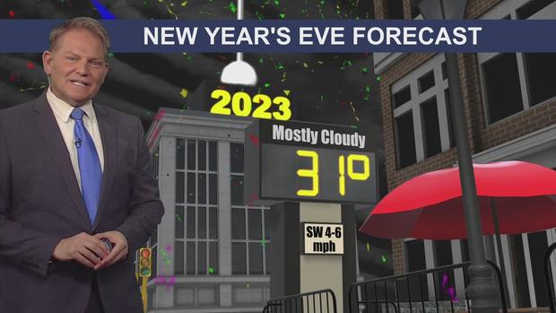
We'll warm back into the mid-30s for the weekend, which means your New Year's plans will be mild ones. It will be 31 degrees in the metro when the ball drops – making it the warmest New Year's Eve in the past 11 years.
It will also be in the mid-30s at Lambeau Field in Green Bay when the Vikings take on the Packers on New Year's Eve.
As we head into next week, we'll deal with a storm system that will likely bring snow out west, but mostly rain in the metro.
Full Vikings @ Packers forecast (and Chris Shaffer score prediction)