NEXT Weather: More record-setting warmth on the way this week


MINNEAPOLIS — Expect a little more sun and a little more warmth on Sunday, and later this week, record-setting highs could be in store.
That additional sunshine will warm the Twin Cities to the mid-40s. Southern Minnesota will see some low clouds and patches of freezing fog early in the day.
A dense fog advisory is in place for parts of Minnesota until 9 a.m. Monday. There will be some isolated slick spots due to a freezing fog, but it should not be too widespread.
Monday will be a couple of degrees warmer, but mostly cloudy. Temperatures will jump to the 50s for Tuesday, Wednesday and Thursday, and the daily record high for each day could fall.
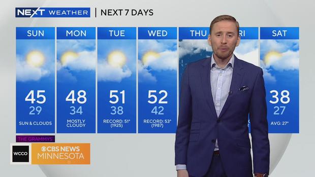
Plan for a mix of sun and clouds for most of the week. On Thursday, a storm system could arrive, bringing rain showers, wind and possible even some very light snow.
Things will cool down after that system, but temperatures will still be above average.