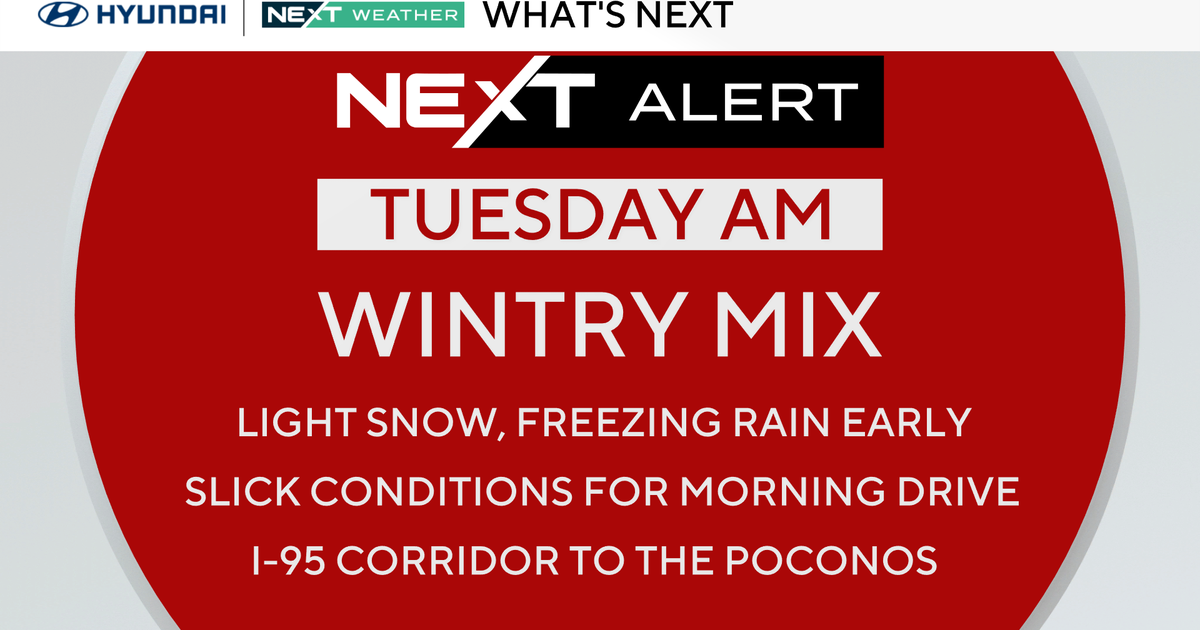
NEXT Weather Alert: Heavy, wet snow to complicate Monday morning commute
Read Monday's live updates here.
MINNEAPOLIS -- A NEXT Weather Alert is in effect due to a storm system that's dropping heavy, wet snow -- and some lightning strikes -- ahead of the Monday morning commute.
A widespread Winter Weather Advisory is in effect, including the Twin Cities and western Wisconsin, through midday Monday.
Most of the snow will fall Sunday night, with 2-4 inches of accumulation expected. WCCO Weather Watchers in communities like Edina, Eagan, Forest Lake, Mahtomedi and Otsego have already measured accumulation between 4-6.5 inches as of late Sunday night. Edina is on the low end, while Otsego is on the high end.
MORE: School closings & delays
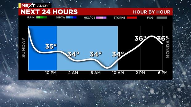
The heaviest snow will fall late Sunday night, before the snowfall lightens up in the overnight, when there is also the potential for icing on roads. The system won't completely move out until late Monday afternoon.
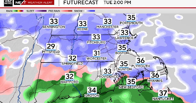
High temperatures will stay in the 30s for the extended forecast. Tuesday will be a dry one, but then more snow chances are possible Wednesday through Sunday. Models are showing that the biggest snowfall next week may be between Thursday and Friday.