Minnesota's wet summer so far has been the dreariest in over 40 years
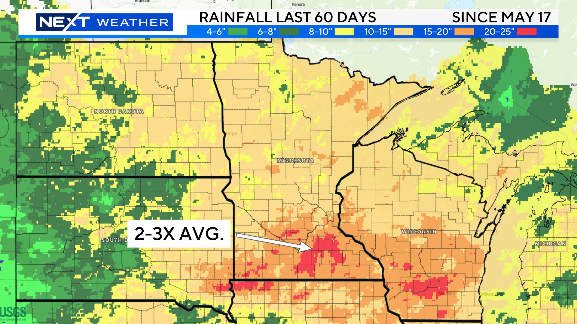
MINNEAPOLIS — It's no secret that Minnesota has been lacking in sunshine as of late. In fact, it's been one of the dreariest first halves of meteorological summer on record in the Twin Cities.
But first, what does "dreary" mean when it comes to weather? WCCO's NEXT Weather team is defining that as days with at least some rainfall. And there have been a lot of those days so far this year.
According to data from the National Weather Service, there have been 30 days with rain between June 1 and July 15 in the Twin Cities. That's already enough to tie for the second-dreariest summer in Minnesota on record. The last time it was this dreary was in 1978.
The No. 1 spot goes to 1969 when there were 32 days of at least some rain in that timespan.
Time will tell just how record-breaking this summer will be when it comes to rain.
Already, the 9.99 inches of rain recorded in the Twin Cities makes it the 13th wettest start to any summer on record.
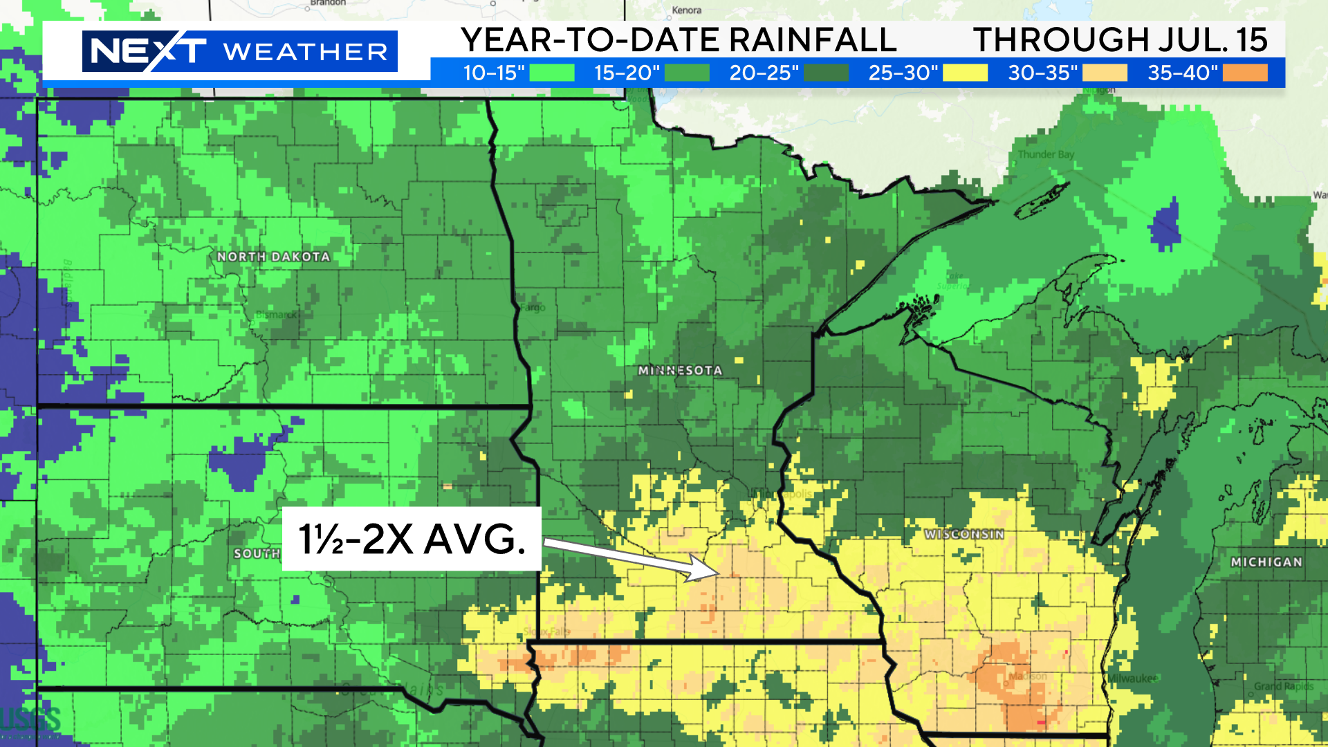
Since the beginning of the year, there's been 23.28 inches of rain — making it the fifth-wettest start to any year on record. That rainfall total makes this year already wetter than all of 2022.
To add to the dreariness, the amount of sunshine recorded at the University of Minnesota's St. Paul campus shows it was the cloudiest start to any summer on their record, according to the Minnesota Department of Natural Resources.
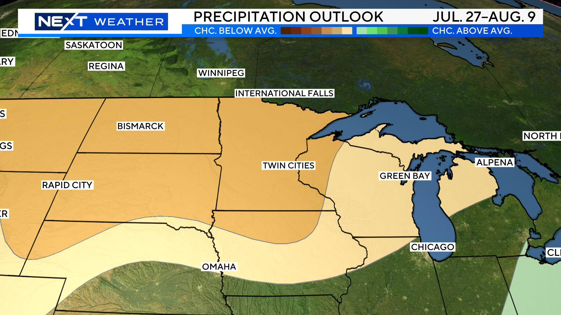
Precipitation outlook: Dry times ahead?
As for what to expect for the rest of the summer, the NEXT Weather's forecast shows a much drier finish to this week and perhaps the longest stretch of rain-free summer weather so far.
According to the National Oceanic and Atmospheric Administration's Climate Prediction Center, chances are good this drier-than-average pattern will take hold from late July through early August.

