Marginal risk of severe storms across southern Minnesota Tuesday night
MINNEAPOLIS — After a sunny and warm start to Tuesday, storms will roll across southern Minnesota.
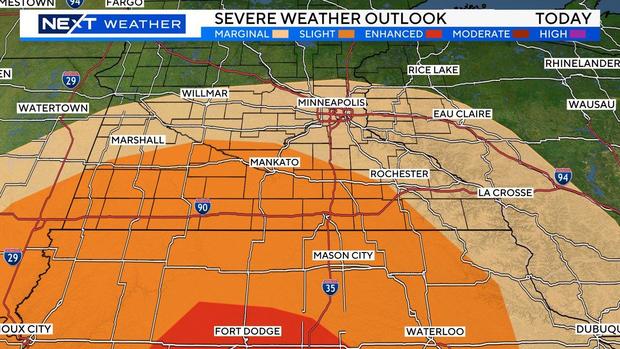
Storms will move from west to east predominately in the southern half of the state, arriving in western Minnesota at about 3 p.m.; the I-35 corridor at about 7 p.m.; and western Wisconsin at about 11 p.m.
There is a marginal risk of hail and damaging winds for the metro and south. The threat is slightly higher for the southern three tiers of counties, with destructive winds and an isolated tornado possible.
Wednesday will be a nice day with highs in the mid to upper 60s and more sunshine.
Rain will return on Thursday, with a chance for a few storms. Showers will linger on and off over the weekend, but we'll see some sun as well.
Highs will return to the 70s Sunday and into next week.


