Severe storms possible Thursday evening in NE, SE Minnesota, including metro


MINNEAPOLIS — Thursday is a NEXT Weather Alert day due to the potential for severe storms.
After fast-moving overnight storms in the Twin Cities, a cold front is triggering a second round in the evening.
A tornado watch is in effect through 11 p.m. in Carlton, Cook, Lake, Pine and St. Louis counties in northeastern Minnesota; and in Burnett and Washburn counties in western Wisconsin.
Most of southeastern Minnesota, including parts of the metro, is under a severe thunderstorm watch until 10 p.m. However, as storms move east, many of those watches are being dropped early.
There is a slight risk (2 on a scale of 5) of those storms turning severe, with the main threats being hail and wind. There is also the possibility of tornadoes along Interstate 35 and in western Wisconsin.
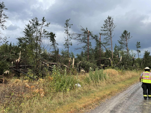
The National Weather Service confirmed a tornado was on the ground about 30 miles north of Duluth around 5:25 p.m.
As the system eventually pulls eastward, Friday will be a day of solace. Expect a sunny day with highs in the lower 80s. In fact, it will be nice enough to warrant a #Top10WxDay.
Saturday should still hold some warmth, with highs in the lower 80s. Passing showers are possible, but it won't be a washout. Rain chances are trending south.
By Sunday, the cooler air arrives, with highs near 70. It looks dry with highs rebounding to the 70s to start next week.