Storms roll into Twin Cities early Tuesday evening


MINNEAPOLIS — Severe weather alerts have been issued in parts of Minnesota on Tuesday as a storm system rolls through the state.
Nineteen Minnesota counties, down the state's center from north to south, are under a severe thunderstorm watch until 8 p.m.
A severe thunderstorm warning was issued west of the Twin Cities, including Montrose and Maple Lake. That warning expires at 5:15 p.m.
The system should reach the St. Cloud area by 5 p.m.; western Hennepin County by 6 p.m.; the metro by 7 p.m.; the east metro by 8 p.m.; and western Wisconsin by 9 p.m. It should fully exit Minnesota by about 10 p.m.
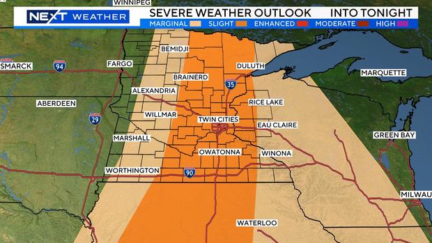
There is a slight threat of severe weather for a wide swath of the state from the north to the south, including the metro. There is a marginal threat for areas further west and east.
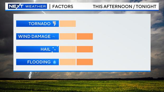
Wind damage is the main threat, followed by flooding and hail, with a low tornado threat. Many locations will pick up another 1 to 1.5 inches of rain. The flooding threat should be held in check with the line passing quickly.
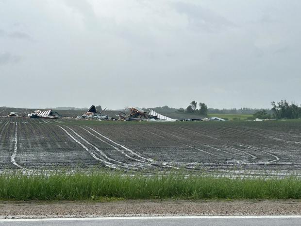
West of the Twin Cities, in McLeod County, the NOAA reported the storm knocked down a shed and injured one.
A few isolated storms are possible midday Wednesday, which will be less humid with highs in the upper 70s.
Thursday will be breezy, but nice, with highs around 70 and sunshine. And the weekend looks dry with highs around or slightly above average.