Twin Cities' warmest, driest September on record ends with one last day in the 80s


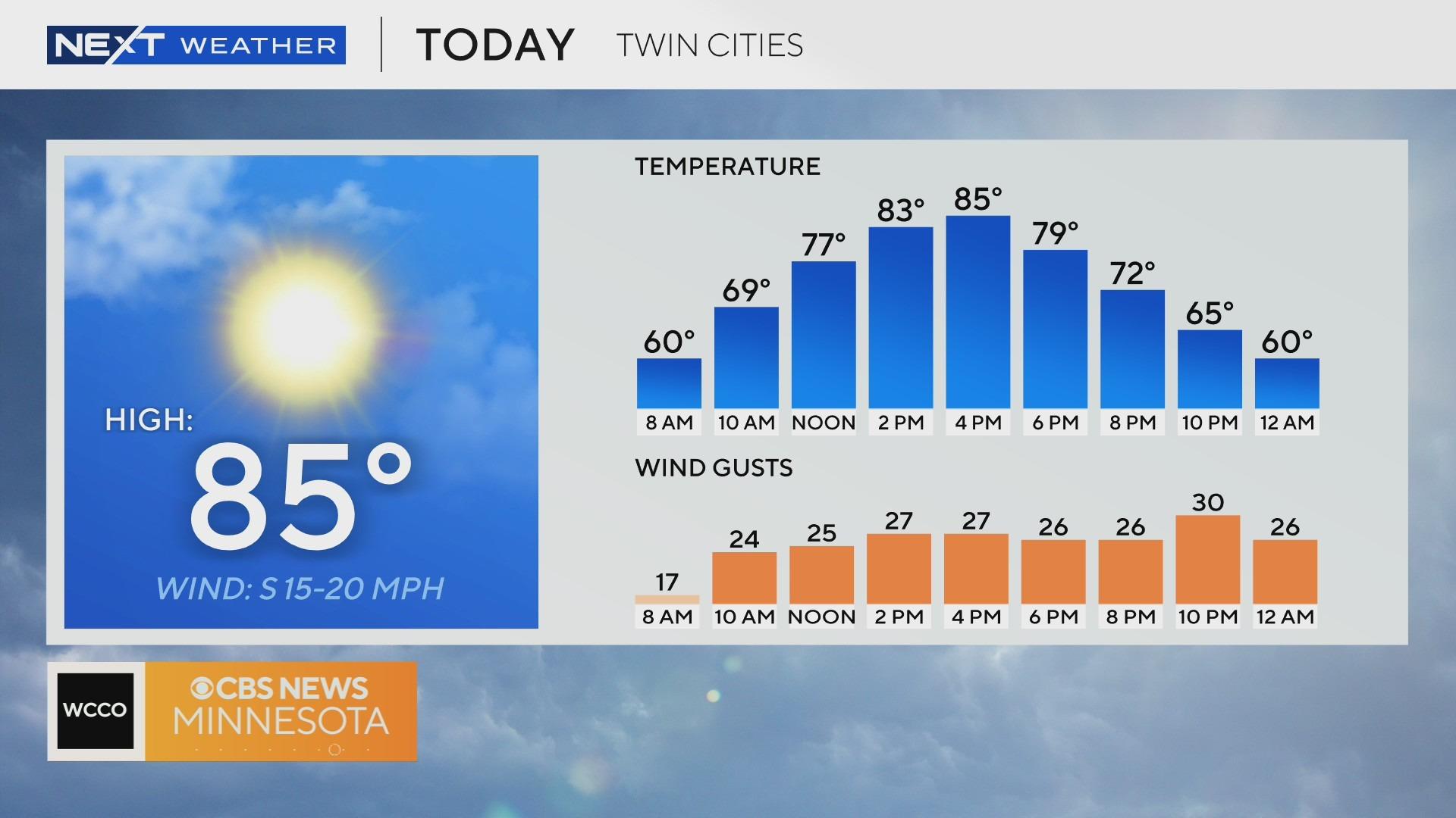
MINNEAPOLIS — The Twin Cities will enjoy one more day in the 80s on Monday, with the winds picking up and fire conditions increasing in western Minnesota.
The forecast high is 85 degrees. There's a surge of warm air before a dry cold front moves through on Monday night.
Due to the wind and the dry conditions, dozens of counties are under a red flag warning for most of the day. Most of the counties are in central and western Minnesota, with the warning expected to expire at 9 p.m. at the latest.
Behind the late-night cold front will be fall air, closing out the month, officially the warmest and driest September on record.
Temperatures will fall to the mid-to-upper 60s on Tuesday to kick off October, which is near average.
We will quickly warm and return to the mid-to-upper 70s on Wednesday as we go up and down this week with temperatures. The wind will pick up again from the southwest around 10-15 mph.
Expect another cold front on Thursday, bringing in more cloud coverage and cooler fall air. There is even a small chance for a pop-up shower.
We head into the weekend with sunshine and 70s.