Fall warm-up continues on Thursday in the Twin Cities


MINNEAPOLIS — High pressure over the Great Lakes continues to dominate our forecast, bringing clear skies and a light southerly wind to the Twin Cities on Thursday.
Those factors will help to get highs into the low 80s on both Thursday and Friday, which is 10 to 15 degrees above average.
Friday will also be our last #Top10WxDay of the warm season.
The ridge will also force Helene, currently a Category 2 hurricane and intensifying, to stall in the Tennessee Valley well to our south before it eventually gets shoved to the east over the weekend.
The outer edges of tropical systems tend to be the driest, which means more sunshine and temps in the low 80s for the metro through the weekend, likely locking in our driest and warmest September on record.
Our next feature looks to be a cold front that will pass midday Monday. However, any precipitation along the boundary will be limited to far northern Minnesota.
Most of the state stays dry, but breezy northwest winds will drop temps back into the 60s, closer to average, by the middle of next week.
Drought update
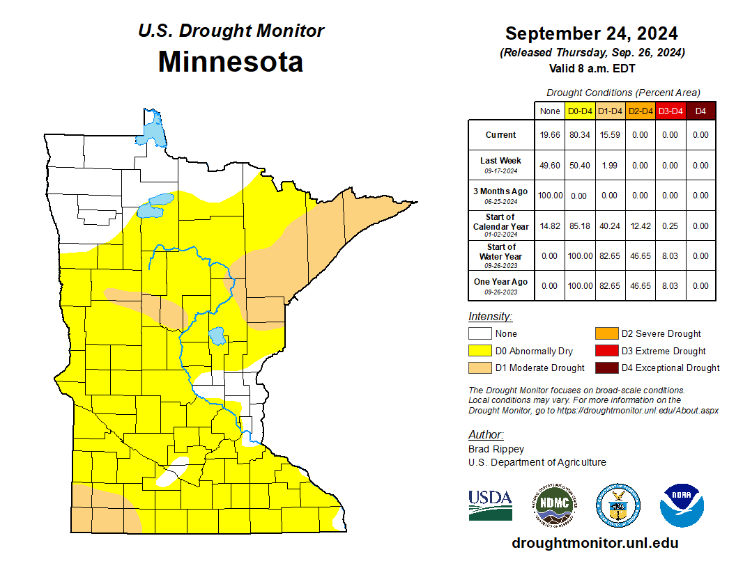
The recent stretch of dry weather — though good for orchards, pumpkin patches and the harvest — continues to promote drought growth, especially across the Arrowhead and southwestern Minnesota.