Minnesota takes break from rain Wednesday before storms return


MINNEAPOLIS — Behind Tuesday's stormy weather, Wednesday will be the only dry day of the week.
Wednesday will be cloudy with a forecast high of 73 degrees in the Twin Cities, more than 10 degrees cooler than muggy Tuesday.
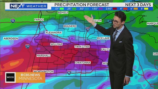
Showers and storms arrive on Thursday by midday. Storms will come and go and a few of them will be strong, but nothing leaning too severe at the moment.
Friday will bring in more showers and temperatures back near or above average. Expect highs in the lower 80s and for humidity to return. There is a marginal risk for severe storms on Friday. Strong winds, excessive rain and flooding will be the main threats.
Rain will linger into Saturday before we dry out on Sunday and Monday.
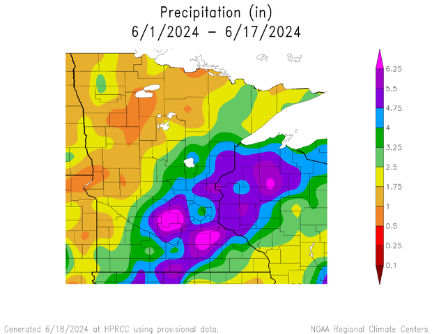
June's excessive rainfall
Almost half of Minnesota has received one and a half to three times as much rain as we typically do by this point in June.
That equates to about 1.50 inches to 4 inches more rain in June than is normal, specifically in the Twin Cities.
Including Tuesday's rain, this is the ninth wettest start to any year since Minnesota weather recordkeeping began in 1871.
The wettest start on record was in 2014, also the most recent year that started this wet. By this time that year, we had had about 3 inches more precipitation.