#Top10WxDay on Friday before rain returns to Twin Cities
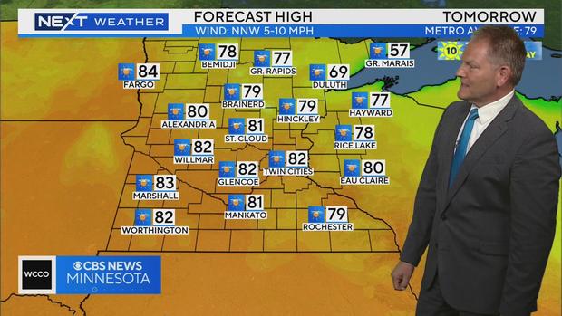
MINNEAPOLIS — After this week's storms and mugginess, the workweek will end with a #Top10WxDay!
Friday is shaping up to be lovely, with sunshine and highs in the low 80s.
Saturday will start nice but will cool as clouds increase and more rain rolls in by the afternoon.
Sunday will feel like summer, with a high dew point and temps near 90 degrees.
Next week looks unsettled with rain chances almost every day.
It will be warm overall with highs in the 80s, and more shots at 90.
Drought update
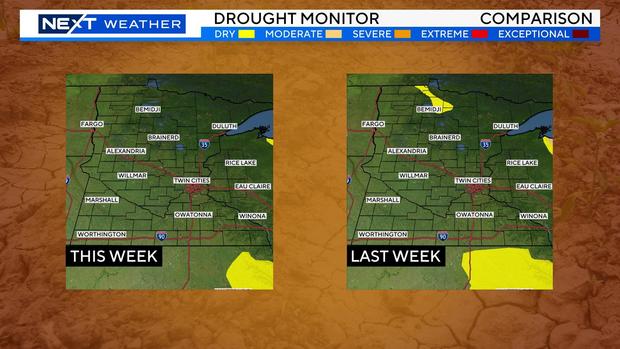
This week's drought update shows that all areas of "abnormally dry" conditions have been erased in Minnesota.
The last time that occurred was more than four years ago.
Wednesday storms leave damage across Minnesota
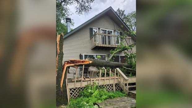
Many Minnesotans will be cleaning up Thursday from a storm system that brought sizable hail, heavy winds and possible tornado touchdowns.
The National Weather Service says a possible tornado was spotted early Wednesday evening near Camp Ripley, northeast of Little Falls, traveling east at 40 mph.
Sizable hail fell across the state, and strong winds wreaked havoc, knocking down power poles and downing trees in spots like Marshall and the Brainerd Lakes Area.


