Cooler, mainly dry Sunday before storms move in late
MINNEAPOLIS — Sunday will be a touch cooler across Minnesota, and mainly dry until late in the evening when more storms could move in.
After some lingering early activity wraps up in southern Minnesota, the rest of the daytime hours should be clear of rain across the state.
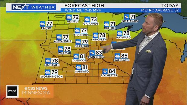
With some extra clouds, highs will top out in the low to mid-80s.
A chance for rain returns late Sunday night into early Monday as a wave of energy rides east. A couple of inches of rain is possible from central Minnesota to western Wisconsin, which could lead to localized flooding.
The best chance for rain in the metro are between 6 a.m. and 6 p.m. on Monday.
There is a chance for severe storms in southern Minnesota with the threat 2 out of 5.
A cooldown is coming this week, with highs falling to the 70s and it will be less humid.
More storms are possible midweek, though they don't look severe at this point.


