A snowy winter storm is heading for Minnesota. Here's the latest snowfall totals forecast.
MINNEAPOLIS — A potentially impactful snowstorm is heading for Minnesota late Wednesday, with plowable snow in areas across the state.
The system will arrive from the northwest Wednesday night and spread east into Thursday morning, then linger through the day before tapering off. A NEXT Weather Alert will be in place for Thursday.
"I think this is going to be the biggest snowfall that we've had so far this winter, and probably the most snow that we have had in one system since last winter, back in March," WCCO Meteorologist Joseph Dames said.
Winter storm warning for Minnesota, North Dakota
The National Weather Service has issued a winter storm warning for multiple cities in northwest and west central Minnesota and southeast North Dakota.
The winter storm warning will go into effect at 9 p.m. on Wednesday and run until 6 p.m. on Thursday.
The cities that may be impacted most by this storm include Ashby, Erdahl, Lisbon, Wahpeton, Valley City, Fargo, Enderlin, Moorhead, Detroit Lakes, Elbow Lake, Lawndale, Hoffman, Fergus Falls, Barrett, McLeod, Herman, Shoreham, and Breckenridge.
The National Weather Service says those areas may see anywhere between three to seven inches of snow and possible wind gusts of up to 40 mph.
How much snow could your area get?
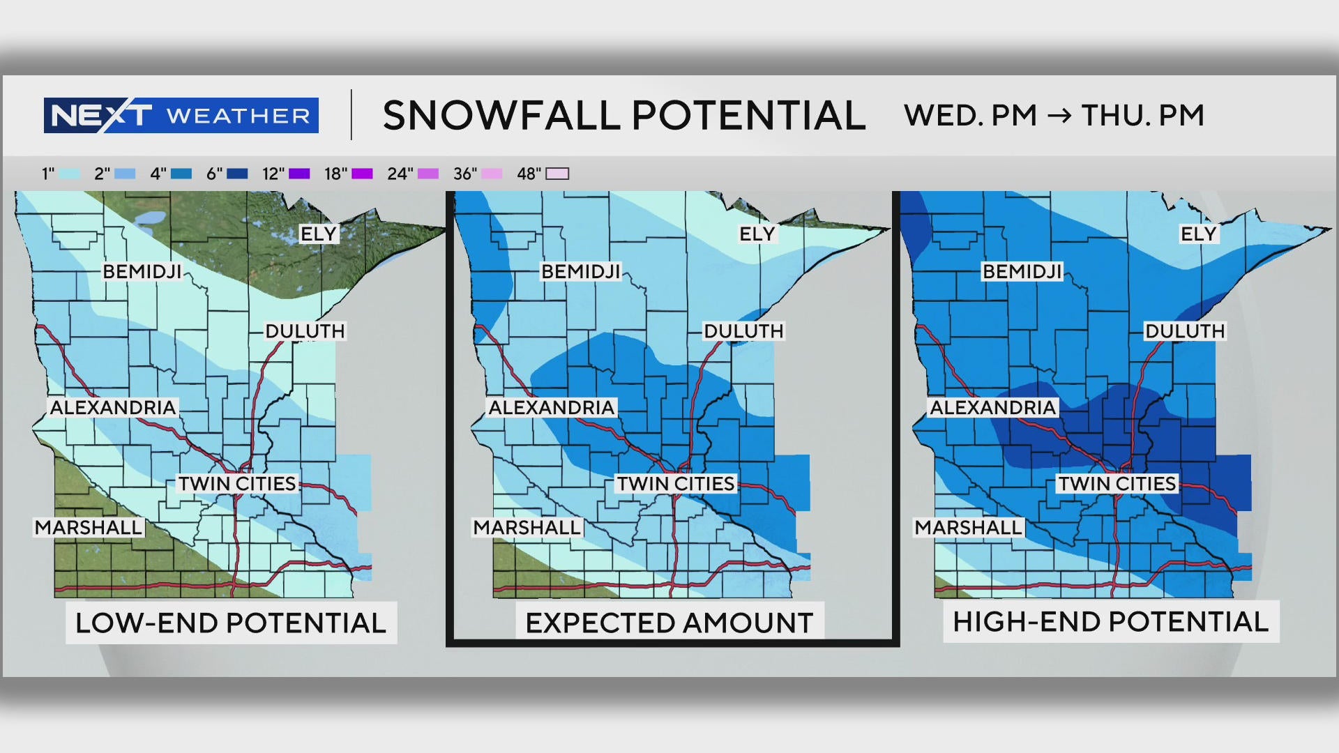
WCCO's NEXT Weather team has looked at the potential storm tracks and offered some estimates.
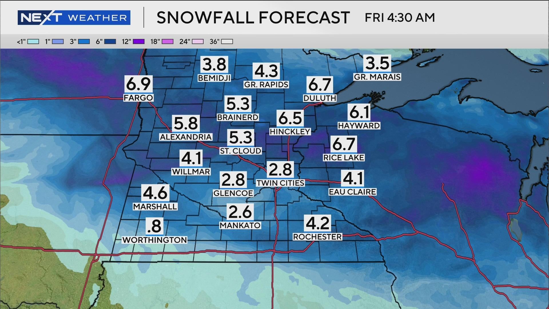
- The Twin Cities could see anywhere from 2-4 inches fall from overnight Thursday through the evening hours. Some isolated spots in the metro could see more.
Southwestern Minnesota will see less than an inch, while parts of the southeast could see anywhere from trace amounts to 4 inches.
Central Minnesota, north of Interstate 94, is likely to get between 3 and 6 inches, the highest projected total in the state as of Wednesday.
Much of northern Minnesota may see anywhere from trace amounts to 4 inches, though far northern Minnesota will likely see less.
Snow start times
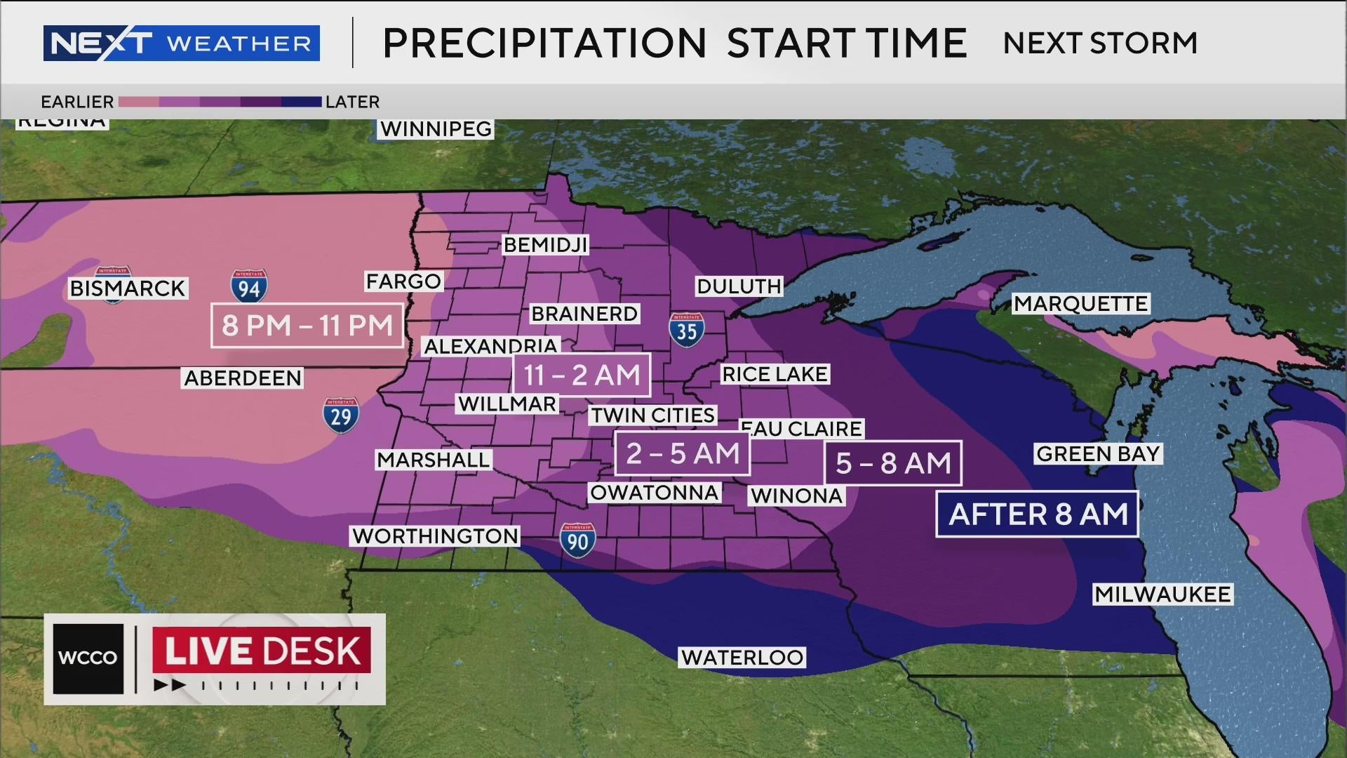
The system will enter the Red River Valley in northwestern Minnesota between 8 p.m. and 11 p.m. Wednesday.
It will reach the Twin Cities sometime between 2 a.m. and 5 a.m. Thursday, with lighter snowfall during this period.
There may be a lull before the storm's intensity increases in the metro between 7 a.m. and 9 a.m.
Snow may fall at a rate of a half-inch an hour during the morning commute, and an inch an hour in central Minnesota.
Snow will keep falling throughout the day, with the system exiting Minnesota overnight Friday.
Traffic impacts
A NEXT Drive Alert is likely for both the morning and evening commutes on Thursday.
As of Wednesday morning, the storm's travel impact level is medium, meaning drivers in the metro can expected fully covered roads, possible crashes and longer drive times.
