Another summery day in Twin Cities Thursday before temps start to drop


MINNEAPOLIS — We're ahead of another dry cold front which will help warm the Twin Cities into the low 80s on Thursday afternoon — about 20 degrees above average.
Cloud cover will grow as the day rolls on but we'll stay dry. Northern lights are possible again on Thursday night, with a severe geomagnetic storm inbound.
That front passes early Friday morning, dropping temperatures into the low 70s, which is still above average. Along with a mix of sun and clouds, it will be a bit breezy with gusts up to 25 mph.
An upper-level trough digs in, bringing even cooler weather for the weekend with 60s on Saturday and 50s on Sunday. Some light showers are possible north and east of the metro.
High pressure drops in early next week, bringing plenty of sunshine that will help get high temps back from the 50s into the 60s by Wednesday.
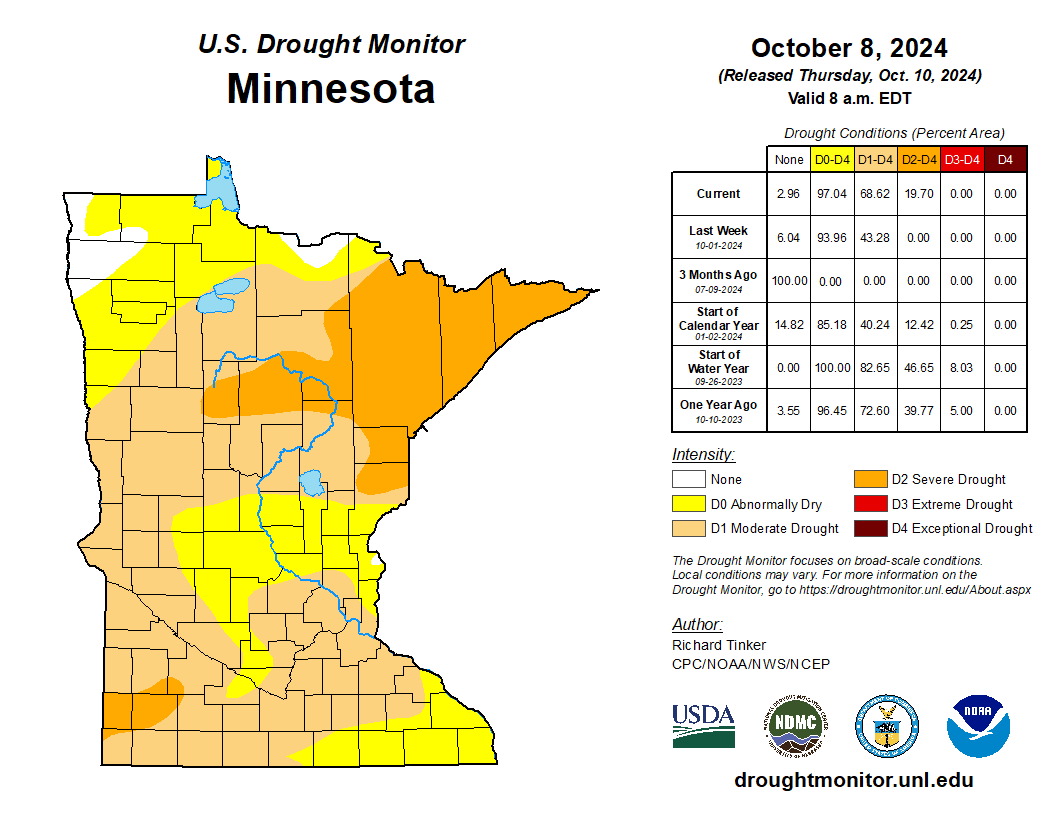
Drought update
MSP Airport is up to 20 consecutive days without measurable rainfall, and the drought is spreading rapidly.
Severe drought is now ongoing across the Arrowhead and parts of southwestern Minnesota. About two-thirds of the state is now in moderate drought.