Twin Cities saw record rainfall in May, and June's off to soggy start


MINNEAPOLIS — May will go down as one of the wettest in Twin Cities history, and June is also off to a soggy start.
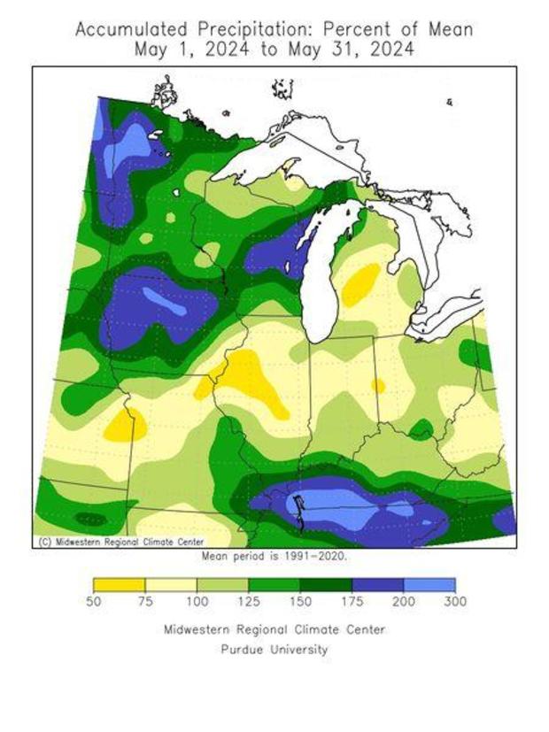
The National Weather Service says 5.81 inches of rain were recorded in May at the Minneapolis-St. Paul International Airport, making last month the 20th wettest May on record, and the third wettest month of any this decade.
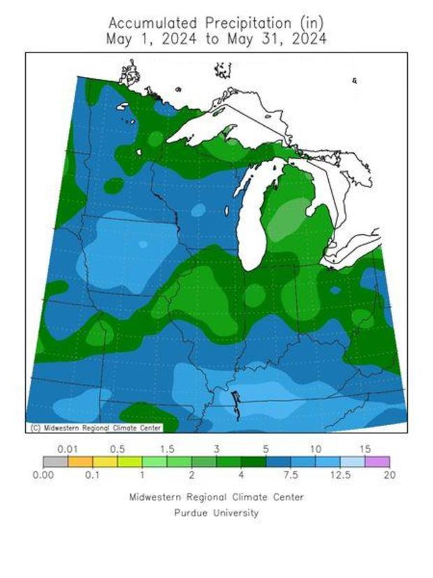
Statewide, May rainfall was double or triple the average in parts of northwestern Minnesota.
The rainiest May on record was 10.33 inches, which occurred in 1906. The second wettest was in 2012 when 9.34 inches fell.
How much rainfall did we get recently in Minnesota?
The rain has also been steady during the first few days of June. According to our NEXT Weather Watchers, much of Minnesota saw precipitation totals ranging from a half-inch to 2.2 inches of rain between Sunday and Monday mornings, with a similar range in the metro.
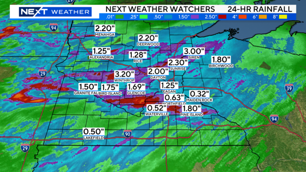
There were pockets of rainfall up north, with some communities seeing 2 inches or more. A Weather Watcher in Winthrop in south-central Minnesota recorded 3.2 inches. The southwest generally saw less.
Communities near Interstate 35 and east can expect more rain on Monday, and there's more rain on the way the next few days before a dry period that could be our longest since early May.
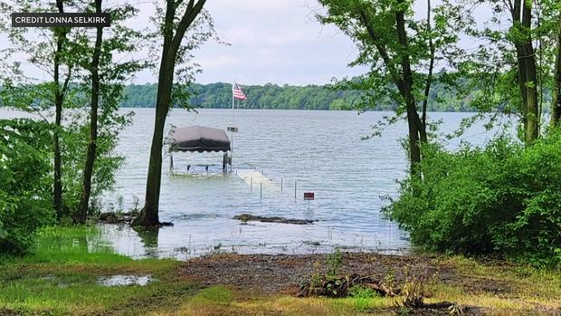
Rains flood parts of Faribault
Over 3 inches of rain fell Sunday night from one storm down in the Faribault area, flooding farmland and covering roads.
The storm also made for a wheel-gripping drive home for resident Lonna Selkirk.
"We've lived here 18 years and I had never seen the exit closed," Selkirk said. "There was lots of water everywhere and rushing water some places."
Heavy rains dropped several inches in just a couple of hours.
"We have a pontoon that was getting too high in the lift so we had to take it out of the lift," she said. "We had trouble getting it out of the lift. Our dock is flooded today."
It's a stark contrast to 2023.
"Last year, we took our boat off early because the water was so low. The lake was down about, we estimate 4-6 feet. And now it's over our dock. So it's a dramatic change from where we were last year," she said. "It's concerning because right now we're saturated, so I'm not sure what that will mean for us. I do see a lot of farmland around us that also has a lot of flooding."
A flood warning is in place for the Cannon River through Thursday morning and even more rain is expected to hit the area on Tuesday.