A warm start to the weekend gives way to chillier temperatures

MINNEAPOLIS — The weekend starts off warm and windy, before a cold front moves in overnight, making for a chilly start to the Twin Cities Marathon.
Saturday's temperatures will warm up to around 80 degrees.
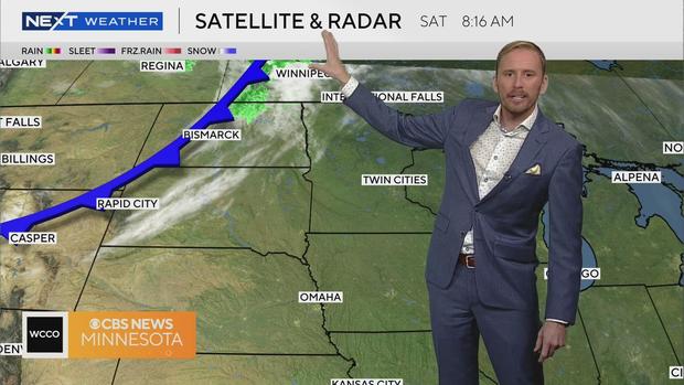
Clouds will arrive by evening, with some rain and thunder, though mostly confined to areas north and east of the metro.
We'll experience gusty winds — up to 35 mph for metro, and potentially even faster out west — all day leading to an elevated fire threat, especially across central and western Minnesota.
Wind advisories and red flag warnings have already been posted for parts of western Minnesota.
Temperatures Sunday and Monday will be closer to the average for this time of year — 60s during the day with overnight lows in the 40s.
Northern lights may be visible again Saturday night as our latest solar storm continues.
High pressure will return next week, with sunshine gradually warming us back up into the 70s.
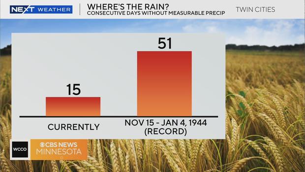
There is no rain in the foreseeable forecast.