NEXT Weather: More showers possible Monday after Sunday's storms


MINNEAPOLIS -- It was a NEXT Weather Alert day Sunday due to potential severe storms in the evening to overnight hours.
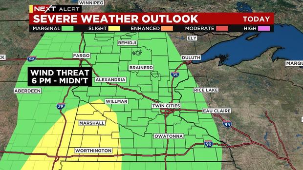
After 6 p.m., storms began developing in southwestern Minnesota, where the risk for severe weather was highest.
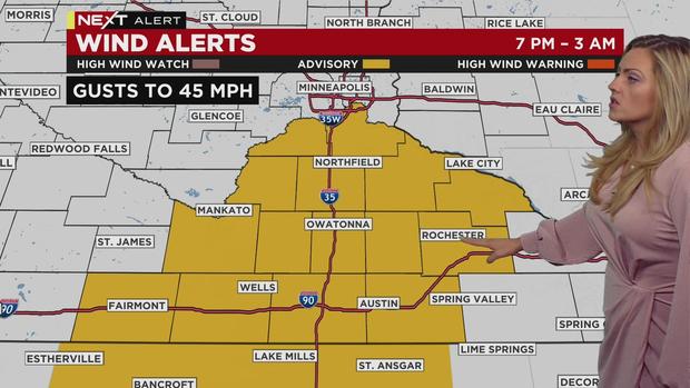
Most of the state was under a marginal risk. Damaging wind was the main threat, with wind gusts of up to 45 mph across southern Minnesota until 3 a.m. Monday.
Hail and isolated tornadoes were secondary threats.
The NEXT Weather Alert ends around midnight, when the storms are expected to die out. Some lingering showers may affect the morning commute.
MORE: Twin Cities Area Radar | NEXT Weather latest
Strong wind gusts will continue on Monday. The week will also start out warm, but temperatures will drop throughout the day. More showers are possible in southeastern Minnesota and western Wisconsin in the evening.
We'll be back down to the 50s on Tuesday, where temperatures will stay the rest of the week.
Check out Sunday's updates below.