Tropical Depression No. 3 Forms To Southeast Of Florida Coast
MIAMI (CBSMiami) -- Tropical Depression number 3 remains disorganized as it moves just to the east of South Florida.
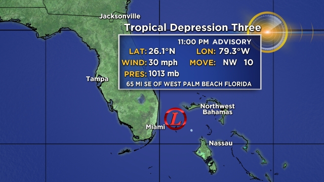
At 11 p.m. Monday, the storm was located about 65 miles Southeast of West Palm Beach, Florida.
There are currently no watches or warning in effect, but interests in the Northwest Bahamas and the east coast of Florida should monitor the progress of this system.
Maximum sustained winds are near 30 mph with higher gusts. The depression is moving toward the northwest near 13 mph.
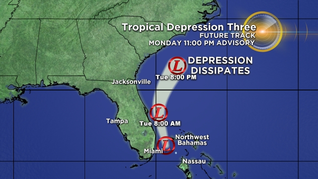
A turn toward the north-northwest is expected overnight followed by a turn toward the north and north-northeast on Tuesday and Tuesday night.
On the forecast track, the center of the depression should remain just offshore of the east coast of Florida over the next day or so.
No significant increase in strength is anticipated, and the depression is forecast to dissipate by Wednesday.
Most of the strong storms are to the right of the storm and with the center forecast to stay off the coast, we may will only see spotty storms with heavier rain that develops and then dissipates.
As the storm moves north off Florida's east coast, our wind will change to the southwest.
Given the deep moisture still in place this will lead to stronger storms along the east coast in the afternoon.


