South Florida cold front will bring relief from above average heat

MIAMI - A cold front moving through South Florida on Thursday will bring relief from the warmer-than-average temperatures as we close out the workweek and head into the weekend.
The front ups the chance of rain to 10-20%. While some areas will see isolated showers, most will remain dry Thursday and Friday.
Thursday is expected to be the coolest afternoon of the month so far with highs around 80 degrees. Winds will increase throughout the day with gusts around 20 to 25 mph possible. This will contribute to a small craft advisory starting which will be issued in the afternoon for the Atlantic waters.
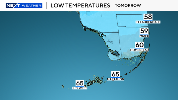
We'll wake Friday morning with conditions feeling like winter in South Florida as temperatures start in the upper 50s to lower 60s. We expect breezy conditions to linger for the morning, so make sure to bundle up to start the day. Afternoon highs peak in the mid-70s on Friday and remain in that range for both Saturday and Sunday.
While the weekend will remain dry overall, the chance of rain will rise late Sunday into the beginning of next week.