Scattered morning showers across South Florida will give way to a drier, breezy afternoon

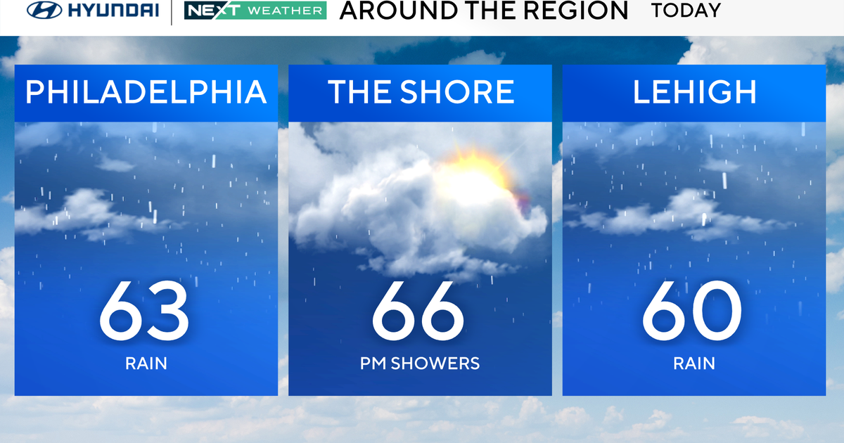
MIAMI - Scattered showers and a few storms moved across parts of South Florida on Thursday morning. The chance of rain will be highest in the morning hours through midday due to the strong easterly breeze. In the afternoon it will be drier, warm, and breezy with highs in the upper 80s.
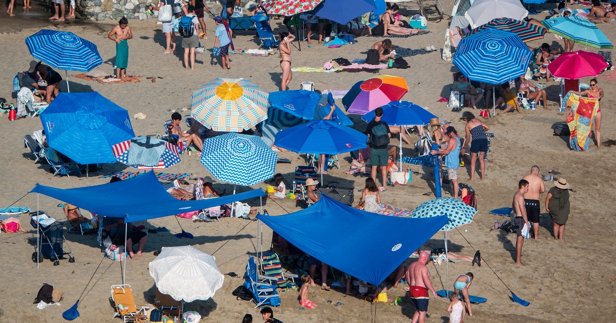
The moderate to strong onshore wind will lead to a high risk of rip currents at the Atlantic beaches through Friday. The National Weather Service recommends swimmers stay within sight of a lifeguard. If caught in a rip current, relax and float. Don't swim against the current. If able, swim in a direction following the shoreline. If unable to escape, face the shore and call or wave for help.
A small craft advisory remains in effect for the Atlantic waters and the Keys through 2 p.m. Thursday due to northeast winds of 15 to 20 knots with gusts to 25 knots. Boaters can expect choppy conditions on the bays, over the Atlantic waters, and rough conditions near shore in the Keys.
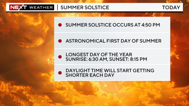
Thursday, June 20th, is the astronomical start of summer with the summer solstice taking place at 4:50 p.m. The summer solstice occurs when the poles are tilted at their maximum toward or away from the sun. It occurs when the sun is directly above the Tropic of Cancer, the circle marking the latitude 23.5 degrees North, which runs through Mexico, the Bahamas, Egypt, Saudi Arabia, India, and southern China, according to the National Weather Service.
The summer solstice marks the longest day of the year and the shortest night of the year. The sunrise in Miami on Thursday took place at 6:30 a.m. and sunset will take place at 8:15 p.m. Moving forward, daylight time will start getting shorter each day.
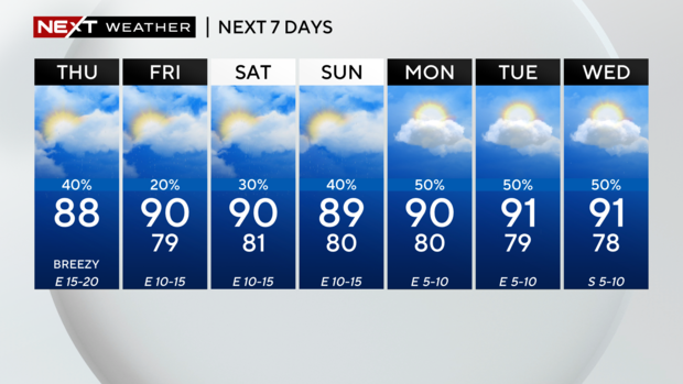
The chance of rain is lower on Friday but the east breeze stays with us and gusts could reach 20 miles per hour. Afternoon highs rise to the upper 80s under mostly sunny skies.
This weekend the winds will lighten up and highs will heat up to around 90 degrees. Passing showers and a few storms will be possible on Saturday and Sunday, but the weekend will not be a washout.
Early next week we return to a more typical summertime pattern with afternoon storms developing every day as the winds shift out of the South. Highs will soar to the low 90s and it will feel like the upper 90s and 100s.