Rapidly Intensifying East Coast Storm To Bring Colder Air To South Florida
Miami (CBSMiami) – The term "bomb cyclone" will likely be associated with forecasts across the eastern United States later this week and weekend.
The term simply refers to a developing area of low pressure which, when the pressure drops 24 millibars over 24 hours, is often referred to a "bomb."
The forecast continue to suggest that from the 24-hour period between Thursday and Friday night an area of low pressure forms off the coast of Florida and, as it moves northeast, rapidly intensifies. Some computer forecasts lower the pressure well over 24 millibars in the 24-hour period.

Similar to hurricanes, the lower the pressure the more intense the storm. As the storm intensifies Friday off the east coast, a northwest wind will develop across the Southeastern United States. This wind direction and speed is what's needed to bring cool dry air here into South Florida.
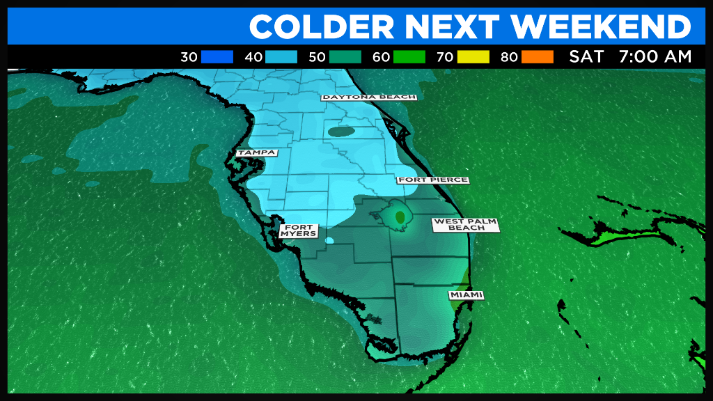
Weekend temperatures will see 50s in the morning with a breeze followed by afternoons in the 70s.
It's not a typical cold front that we can see coming but the results will be similar.