Is It Really Spring? 4th Nor'easter In 3 Weeks Closes Schools, Delays Flights
Follow CBSMIAMI.COM: Facebook | Twitter
NEW YORK CITY, NY (CNN) -- The fourth nor'easter in three weeks already is closing schools and canceling thousands of flights Wednesday as it's expected to dump record springtime snow in the Northeast.
A day after the official beginning of spring, the storm will bring heavy snow, strong winds and even coastal flooding to some areas. It has potential to be one of the most significant and most disruptive snowstorms this late in the season, CNN meteorologists said.
"If the current forecast pans out, this nor'easter will dump more snow on Washington, Philadelphia and New York than the three earlier storms combined," CNN meteorologist Brandon Miller said.
More than 70 million people are under a winter storm watch, warning or advisory from the southern Appalachians to Boston.
The storm will move away from the region by Thursday but not without first hitting coastal New England and Maine.
Latest developments
• More than 4,100 flights are canceled Wednesday due to the storm, according to the tracking site Flightaware.com.
• Public schools in New York City, Philadelphia and the District of Columbia are closed Wednesday.
• The storm already dumped 13 inches of snow in Greencastle, Pennsylvania, and blanketed Smith Crossroads in West Virginia with 9.2 inches.
Snow disrupting nation's capital
Washington will likely see 4 to 6 inches of snow, with some models hinting at much higher totals for the District. Areas west and north of the city are likely to see close to a foot of snow.
"It's been 75 years since Washington has had 5 inches of snowfall or greater this late in the season," Miller says.
Track the storm with high resolution auto-updating graphics
The inclement weather caused closures for much of the federal government. The White House and State Department canceled all public events for the day. However, the House and Senate are planning to work Wednesday as Congress tries to finalize a spending deal.
Philadelphia could see up to a foot of snow. The City of Brotherly Love may get its biggest snowfall after the first day of spring in more than 100 years.
For those in other parts of Pennsylvania, the storm was already well underway Wednesday morning. Thile Kreider posted an Instagram video of the snow blanketing her yard in Manheim.
New York could break 1958 record
Wind gusts and snow reached New Jersey and New York City on Wednesday morning.
Ten inches to more than a foot is forecast in the New York City area before the storm departs early Thursday.
But Central Park in Manhattan may only receive 4 to 6 inches of snow, CNN meteorologist Chad Myers said, explaining it's more likely snow will accumulate in areas at higher elevations.
"If New York gets 12 inches of snow -- the National Weather Service currently has a high-end potential of 13 to 21 inches -- it would be its largest snowfall ever recorded after the first day of spring," Miller says.
The current record is 11.8 inches, set on March 21, 1958.
With these late winter storms, it is difficult to predict snowfall amounts because of the mixing of warmer air. In some of the earlier nor'easters, the air near the ground has stayed warm enough that places like New York have seen lots of snow fall from the sky but had little accumulation. An urban heat island effect is plausible once again with this spring storm.
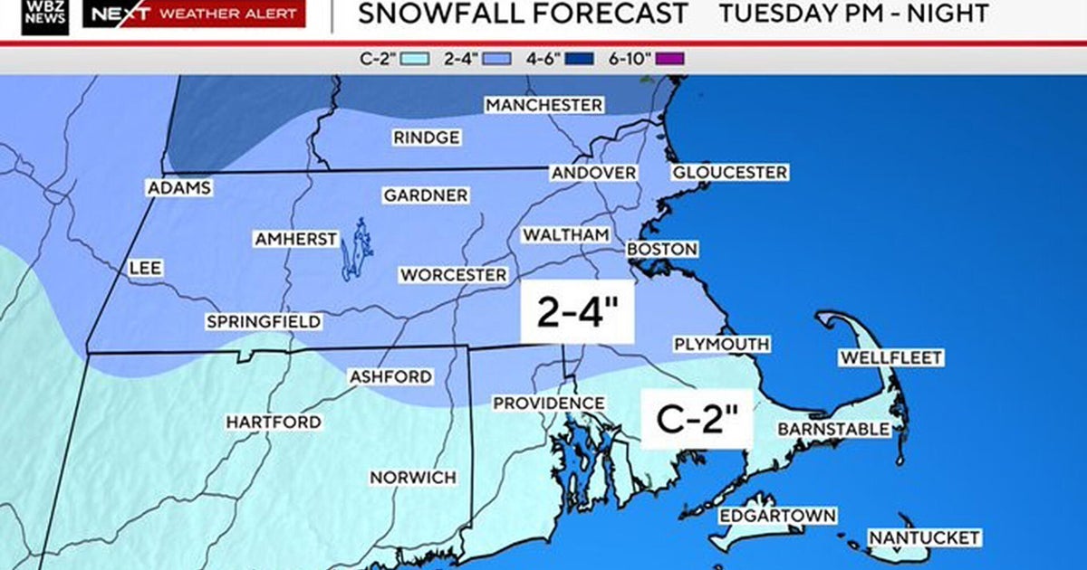
Boston stayed on the warmer side in the first two nor'easters but then got walloped with snow during the third storm this month. The city is likely to see another 6 to 8 inches of snow, adding to the 20-plus inches it has already received in March.
If Boston gets 10 inches, the city would have its third snowiest March on record.
These late winter storms are likely to become more frequent with climate change. A study last week in the scientific journal Nature Communications ties extreme winter weather, specifically major snowstorms in the Northeast, to warming Arctic temperatures.
Blizzard conditions likely
With a forecast of heavy snow and winds more than 45 mph, blizzard conditions are possible.
New York City could see sustained winds of 20 to 30 mph Wednesday, and coastal areas such as Cape Cod in Massachusetts are predicted to receive gusts up to 60 mph from midmorning Wednesday to Thursday.
What is makes a snow storm a blizzard
Flooding is a threat along the coast from Virginia to Massachusetts. Some of the worst coastal flooding could occur along the Jersey Shore, with high tides of 2 to 3 feet above normal possible.
This will put a strain on already vulnerable coastal areas, which saw dramatic storm surges from the nor'easters over the last three weeks.
The-CNN-Wire
™ & © 2018 Cable News Network, Inc., a Time Warner Company. All rights reserved.
