NEXT Weather Alert: Drought busting heavy rain, potential flooding Tuesday through Friday
MIAMI - Deep tropical moisture will move into the Gulf of Mexico and spread east over the Florida Peninsula throughout the day on Tuesday.
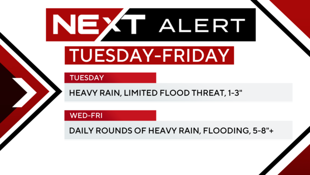
A NEXT Weather Alert has been issued because this will lead to waves of rain and storms that will move through the area starting Tuesday and continuing through Thursday. These rainy periods will come at any time, not limited to the daytime heating and storms that we typically see during the summer months. By Wednesday and Thursday, the ground will be saturated so additional rainfall will likely lead to flooding.
The Weather Prediction Center has the five-day rainfall forecast at 5 to 8 inches across all of South Florida and the Keys.
By the end of the week and the weekend, the area of moisture and heavy rain will begin to move into the Gulf and away from South Florida. It is at this time that we will return to the typical daytime showers and storms that develop during the day.
Monday will be the hottest day of the extended forecast with highs above 90 degrees before the storms develop. Tuesday through the weekend with clouds and rain highs will be in the upper 80s with morning lows in the upper 70s.

