NEXT Weather Alert Day: Tuesday afternoon saw heavy downpours
A NEXT Weather Alert had been declared for Tuesday because the National Weather Service's Storm Prediction Center had issued a Level 1 out of 5 (Marginal) risk for severe storms across Broward and Miami-Dade counties.
The day started out calm and muggy, but NEXT Weather meteorologist KC Sherman said storms would develop after 2 p.m.
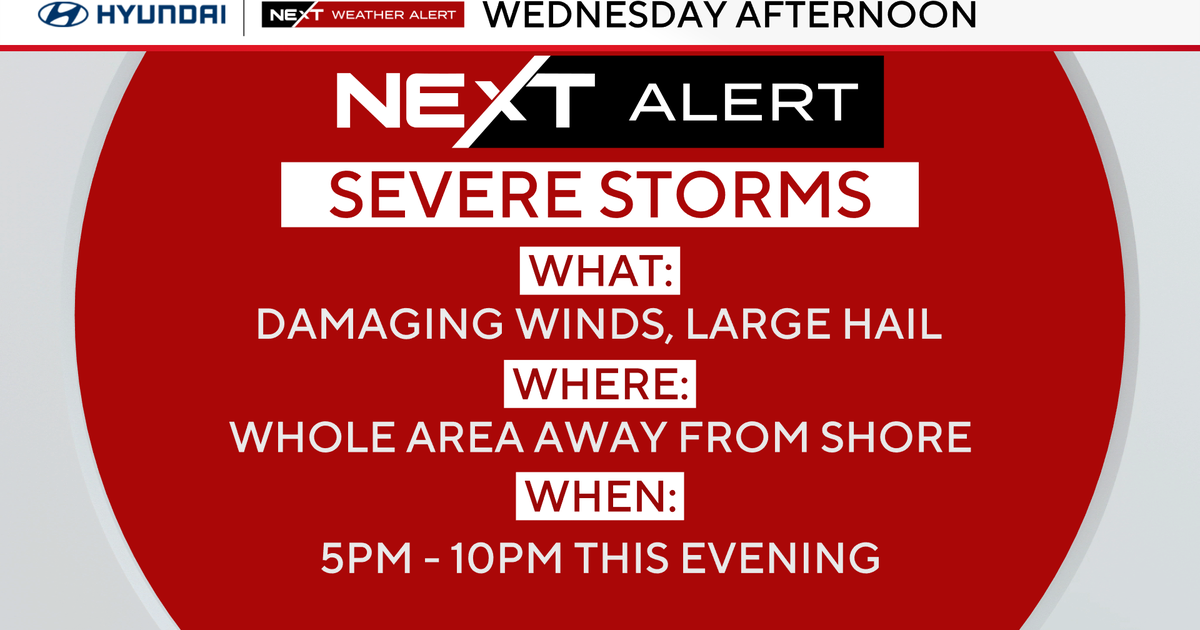
The storms came ahead of a front that will work its way down the state. The front is expected to pass through South Florida on Wednesday night.
Ahead of that we saw some much-needed rain across our area, including isolated thunderstorms, which produced heavy downpours.
Some areas saw more rainfall than we have had for the entire month.
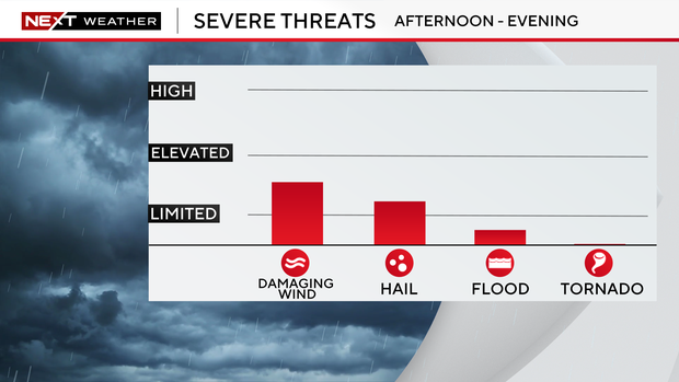
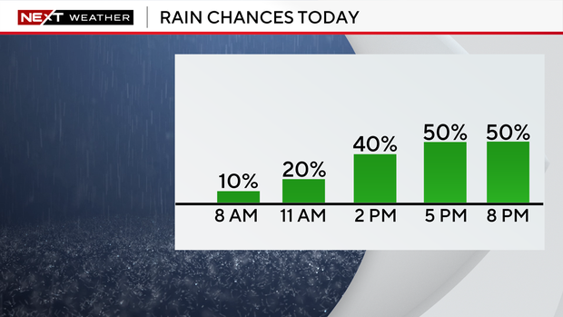
Wednesday will be a drier day with isolated showers and storms ahead of the front, but they will mainly be focused over the inland areas.
While the front will bring a little cooler weather, it will drop our humidity for Thursday and Friday. Highs will be in the upper 70s.
The chance of rain will tick up for the weekend, we could see isolated showers and spotty storms. Sunday looks to be the wetter day.