A cool start in South Florida gives way to a mostly cloudy, warm afternoon

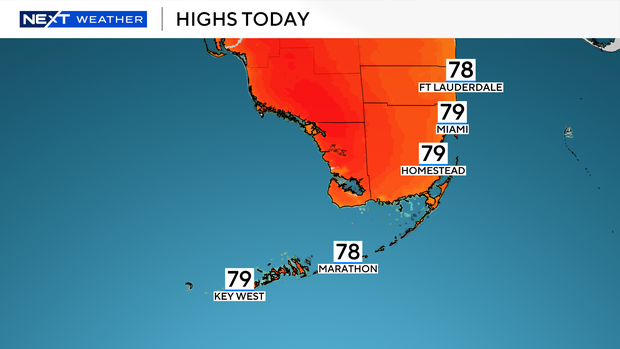
A cool start to your Sunday will lead to a mostly cloudy and warm afternoon with highs around 80 degrees for all of South Florida.
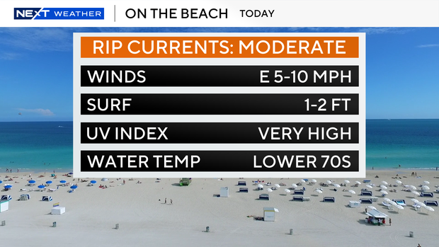
If you're heading to the beach today, there will be a moderate rip current risk along with wind from the east at 5 to 10 mph. There are no marine alerts for the Atlantic Waters or Florida Keys at this time.
The evening will remain mild as temperatures drop to the upper 60s to lower 70s overnight.
While there is no concern for rain today or Monday, you'll want to keep the umbrella nearby for Tuesday and Wednesday this week.
A cold front is forecasted to move into South Florida on Tuesday and fizzle apart on Wednesday.
This will bring about a 30-to-40 percent chance for scattered showers and thunderstorms both days.
Ahead of the front, temperatures will climb to the lower to mid-80s each afternoon. Since the front will be fizzling apart over South Florida, we won't see cooler air move into the area.
This will keep our afternoon highs in the lower 80s for the rest of the work week.