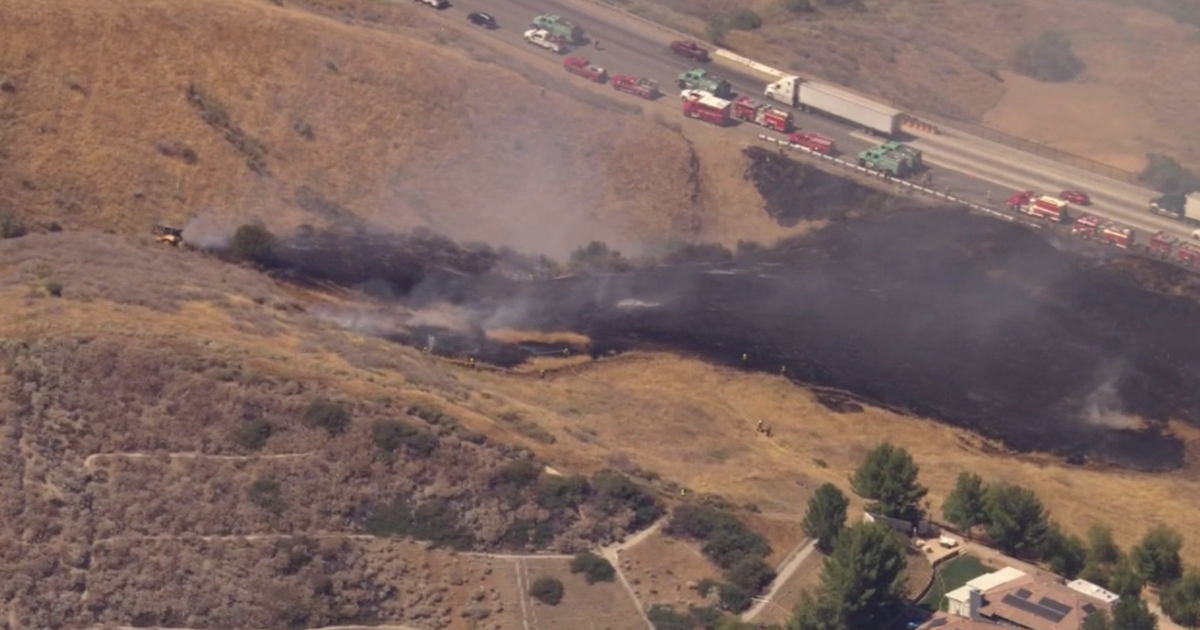
Nixon Fire grows to 5,222 acres, continues to burn vegetation east of Temecula
The Nixon Fire continued to burn Friday, four days after it started near the Riverside and San Diego County line.
By Saturday afternoon, the wildfire had burned 5,222 acres and was 48 percent contained. Officials said they expect to achieve full containment by Aug. 7.
Firefighters kept the fire within existing perimeters Thursday night, but monsoons may produce lightning and increased winds Friday, officials said.
The Nixon Fire began Monday afternoon near Tule Valley Road and Richard Nixon Boulevard in the small town of Aguanga. As it moved east toward the Beauty Mountain Wilderness area, the wildfire destroyed four buildings, forced people out of their homes and raised concerns about air quality.
Resident Matthew Hendricks said the Nixon Fire burned down his chicken coop and shed, which controlled the irrigation on his property.
"It's going to cost me $5,000 to $10,000 to get this fixed," Hendricks said as he surveyed the damage. "Which I don't have."
Others, like Richard Enriquez, lost everything.
"I'm broke," Enriquez said. "I ain't got no money. I lost everything."
As of Wednesday morning, Cal Fire officials said there was no further immediate threat to homes or other structures. At its peak, the Nixon Fire threatened to burn down 1,783 buildings and four structures were destroyed, officials said Thursday.
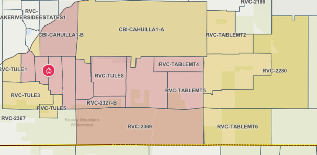
Evacuation orders and warnings
The evacuation orders and warnings firefighters issued on Monday have not changed and remain in place.
Evacuation orders:
- RVC-TULE2-A
- RVC-TULE2-B
- RVC-TULE4
- RVC-TULE6
- RVC-TULE7
- RVC-TULE8
- CBI-CAHUILLA1-B
- RVC-2327-A
- RVC-2327-B
- RVC-TABLEMT4
- RVC-TABLEMT5
The evacuation orders' roadway boundaries are north of Cooper Cienega Trail, south of Bailey Road, east of Holly Ann and west of Terwilliger Road.
Evacuation warnings:
- RVC-TULE1
- RVC-TULE3
- RVC-TULE5
- RVC-LAKERIVERSIDEESTATES4
- CBI-CAHUILLA1-A
- RVC-2369
- RVC-TABLEMT2
- RVC-TABLEMT3
- RVC-TABLEMT6
- RVC-2280
The evacuation warning boundaries are north of the San Diego-Riverside County Line, south of Heller Springs Road, east of Terwilliger Road and west of Table Mountain Truck Trail.
Firefighters converted Temecula Valley High School into an evacuation center for residents and their pets. Animal services will be available to help owners and their pets. The center is at 31555 Rancho Vista Road, Temecula.
Air quality concerns
The South Coast Air Quality Management District issued a smoke advisory for the Nixon Fire, which was set to expire Thursday at 6 p.m.
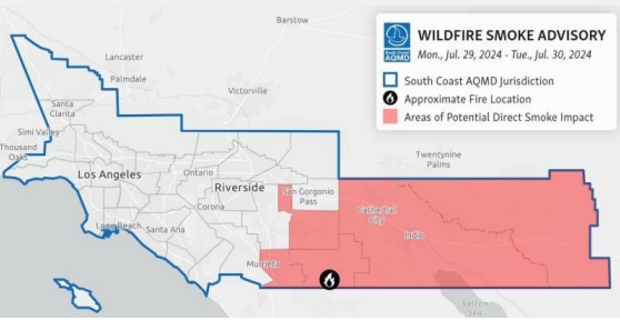
AQMD believes winds will push smoke from the fire to the northeast, degrading the air quality to at least "Very Unhealthy" levels in the areas immediately adjacent to the fire, including Anza. The fire is expected to degrade the air to "Unhealthy" levels in Hemet, San Jacinto, the Coachella Valley and eastern Riverside County.
The regulatory agency recommended that residents limit their time outdoors, avoid vigorous physical activity, run air conditioners or air purifiers, avoid burning wood and minimize the use of candles, incense, pan-frying and grilling. Those who must go outside were advised to wear an N95 mask or P100 respirator.