Chicago weather: Powerful storms, tornadoes pound area
Powerful storms Wednesday afternoon and evening produced torrential rain, damaging winds, and several tornado warnings.
The National Weather Service has confirmed at least seven tornadoes and one waterspout.
For example, an apparent tornado was spotted in Campton Hills, a suburb in Kane County west of Chicago.
Seven total tornadoes confirmed so far
The National Weather Service said its survey teams have confirmed at least seven tornadoes so far from Wednesday's storms.
In addition to two tornadoes in Elgin, one along the I-55 corridor between Burr Ridge and Stickney, and one in Oswego, survey teams also confirmed an EF-1 tornado in Huntley, with maximum winds of approximately 90 mph; an EF-0 tornado in Barrington, with maximum winds of about 80 mph; and an EF-0 tornado in Long Grove, with maximum winds of approximately 70 mph.
A waterspout also has been confirmed to have occurred about a mile or two offshore of North Avenue Beach.
The National Weather Service said it still has survey teams in the field working to confirm other possible tornadoes.
EF-0 tornado confirmed in Oswego
The National Weather Service has confirmed a fourth tornado from Wednesday's storms.
The EF-0 tornado, with peak estimated winds of 85 mph, touched down in northeastern Oswego and eastern Boulder Hill.
National Weather Service confirms tornado from Burr Ridge to Stickney
Thursday afternoon, the National Weather Service confirmed an EF-1 tornado, with maximum winds near 110 mph, hit along a path from Burr Ridge to Stickney, uprooting trees, and causing significant damage to several businesses.
CBS 2's Jermont Terry was in southwest suburban Lyons on Wednesday night near McCook, along the tornado's path, where the storm ripped through, causing debris to fall and powerlines to be downed which started a fire near an industrial facility. Dozens of buildings in the area sustained damage.
National Weather Service confirms two tornadoes in Elgin
The National Weather Service confirmed Thursday that an EF-1 tornado with a maximum wind speed of 100 mph touched down in Elgin during Wednesday's storms, moving from east of Route 47 to the railroad tracks west of VIlla Olivaia Golf Course.
A second tornado, an EF-0 intensity twister with a maximum wind speed of 85 mph, touched down close to McDonald Road and ended along Hopps Road.
Storm Recap with Jackie Kostek: Albert's Warning, chaos at O'hare
Storm damage in Elgin
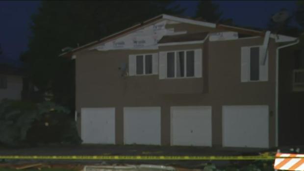
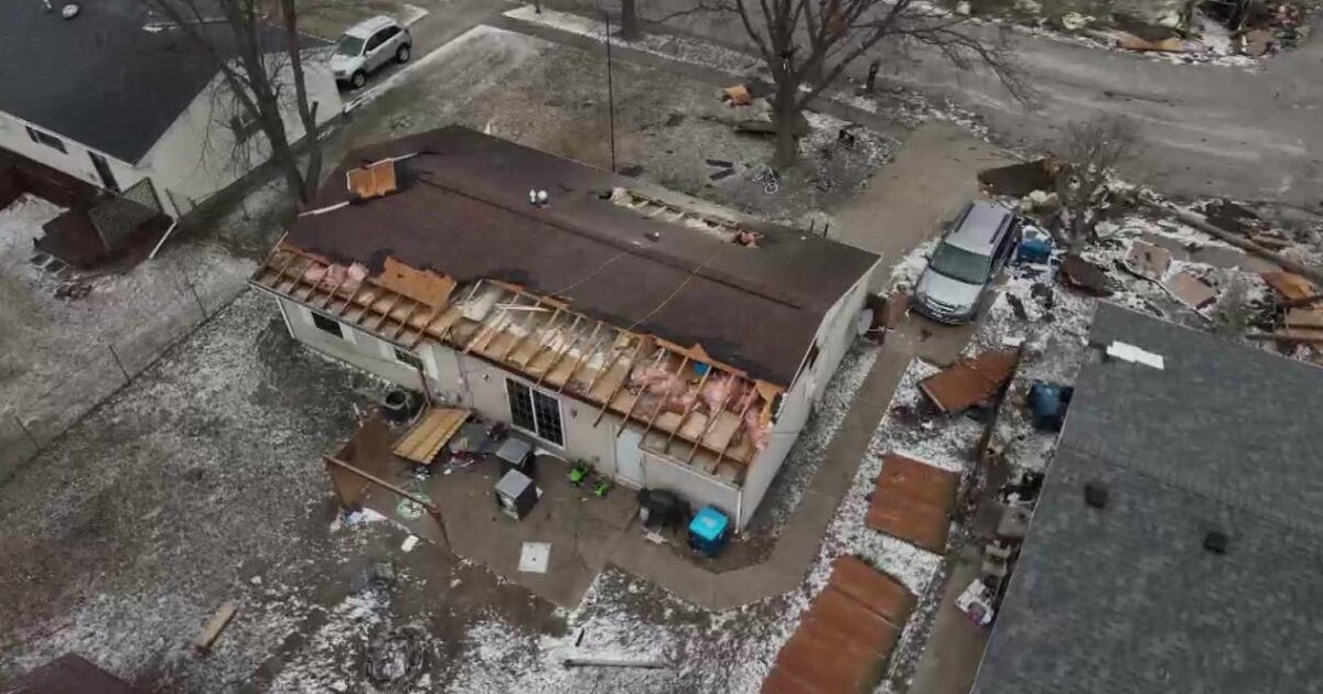
Several homes in northwest suburban Elgin were damaged after a tornado appeared to rip through the community.
Chopper 2 and Kris Habermehl were over a neighborhood in Elgin where a tornado caused extensive damage to several homes Wednesday night.
The homes appeared to have sustained significant structural damage. Several emergency response agencies were in the area around Stoney Creek Drive.
Crews have been busy overnight, clearing the area. With widespread damage, Kane County and the city of Elgin are working with the Salvation Army and the Red Cross to help people forced out of their homes by storm damage.
At last word, there were no injuries in Kane County.
More than 1,100 still without power
While the majority of people who lost power during Wednesday evening's storms have had service restored, ComEd was reporting more than 1,100 outages as of Thursday morning.
Here's a breakdown by county as of 10:40 a.m.:
Cook - 806 customers without power
DuPage - 103 customers without power
Lake - 90 customers without power
Winnebago - 78 customers without power
McHenry - 57 customers without power
Will - 24 customers without power
Boone, Joe Daviess, Kane, and Kendall counties each have fewer than 5 customers without power.
Storm damage in Huntley
CHICAGO (CBS)-- Huntley residents are waking up to widespread storm damage after tornadoes touched down across the Chicago area Wednesday night.
Strong winds downed massive trees that are being removed Thursday morning.
Some residents are still without power.
Thousands of ComEd customers affected by storms
More than 7,000 ComEd customers were affected by Wednesday's storms throughout Northern Illinois, the utility company reported. The company serves more than 4 million in the region.
Here's a breakdown by county in the Chicago area.
Cook: 5,452
DuPage: 252
Kane: 983
Lake: 218
McHenry: 134
Will: fewer than 5
Several homes in Elgin badly damaged by tornado
Storm causes damage, downs powerlines in Lyons
Wednesday's storms left a trail of damage through multiple southwest suburban communities along the Interstate 55 corridor.
CBS 2's Jermont Terry was in southwest suburban Lyons near McCook where a storm ripped through, causing debris to fall and powerlines to be downed which started a fire near an industrial facility. Dozens of buildings in the area sustained damage.
Lyons Fire Chief Gordon Nord said the damage "certainly appears to be" due to a tornado. He said the damage at a trucking company happened right at the border of Lyons and McCook on 47th Street.
"It looked very nasty," Nord said. "You could see debris floating around in the clouds and then all of the sudden we started getting the calls."
He added sirens went off three times in Lyons.
Storm downs trees, rips roof off home in Countryside
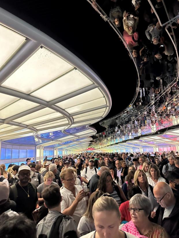
Crowds of travelers take shelter at O'Hare Airport
Tornadoes spotted near O'Hare International Airport sent a multitude of travelers into the moving walkway between the United Terminal.
When she took this video, Hannah Follman, a morning reporter for FOX59/CBS4 Indianapolis, was trying to catch a flight to London. She was on the plane when officials ordered everybody off to take shelter as a tornado was spotted nearby.
"It was definitely a crazy flight," Follman said. "We had actually already boarded the airplane before the tornadoes were in the area."
She said the pilot had hoped to beat the weather. Then just a few minutes later, a flight attendant told everybody to get off the plane immediately and seek shelter.
The flight attendant said, "Everyone get your belongings, you need to get off the plane immediately," Follman said. "It was just a rush."
Follman said it took about 15 to 20 minutes to get everybody into a safe place. Aside from a few moments of pushing and shoving, the crowd was generally well-behaved.
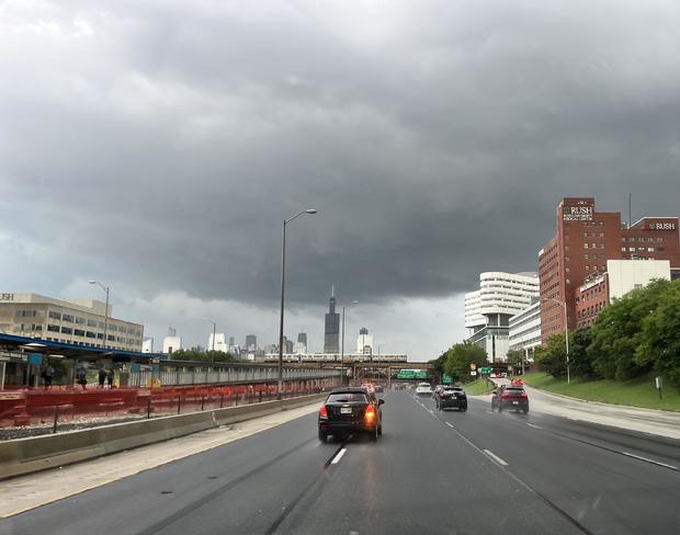
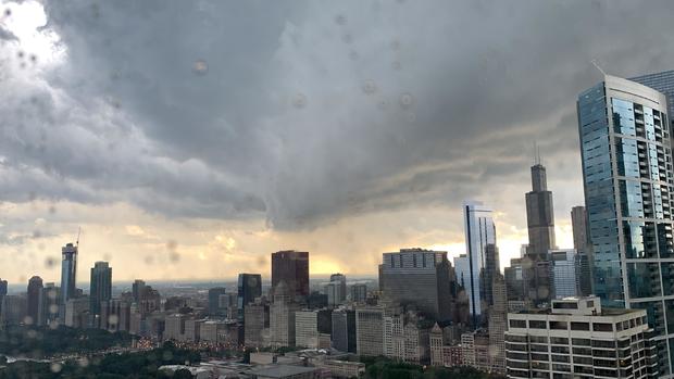
View of city as storms sweep in
Storm damage in south suburban Hodgkins
CBS 2 photojournalist Scott Placko captured the aftermath of the storm damage on south suburban Hodgkins on Wednesday as much of the Chicago area was under tornado warnings.
The roads were open even as debris was all over the ground, including a stop sign bent completely over, likely due to strong winds.
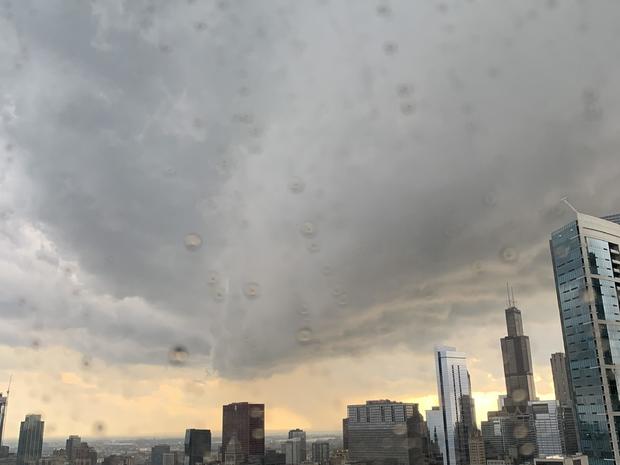
Ominous clouds over Maggie Daley park
CBS 2 video journalist George Umbenhauer captured these images of dangerous clouds forming over the Loop around 6:30 p.m.
Video: Tornado spotted in Campton Hills
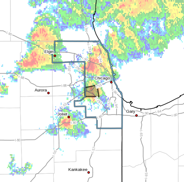
New tornado warning for Cook, Chicago
BULLETIN - EAS ACTIVATION REQUESTED
Tornado Warning
National Weather Service Chicago/Romeoville
700 PM CDT Wed Jul 12 2023
The National Weather Service in Chicago has issued a
* Tornado Warning for...
Northeastern Cook County in northeastern Illinois...
* Until 745 PM CDT.
* At 659 PM CDT, severe thunderstorms capable of producing tornadoes
located along a line extending from Des Plaines to Villa Park,
moving east at 35 mph. These storms have an extensive history of
producing tornadoes.
HAZARD...Tornado.
SOURCE...Radar indicated rotation.
IMPACT...Flying debris will be dangerous to those caught without
shelter. Mobile homes will be damaged or destroyed.
Damage to roofs, windows, and vehicles will occur. Tree
damage is likely.
* These dangerous storms will be near...
Franklin Park, Schiller Park, Hillside and Rosemont around 705 PM
CDT.
Glenview, Park Ridge, Niles, Melrose Park, Maywood, Westchester,
Norridge, Morton Grove, Bellwood and Harwood Heights around 710 PM
CDT.
Skokie, Berwyn, Austin, Portage Park, Dunning, Elmwood Park,
Forest Park, River Forest, River Grove and North Riverside around
715 PM CDT.
Any storm right now has potential to be tornadic
To keep this simple, assume that any storms moving through the area right now have the potential to spin into a tornado.
There is a lot of rotation in the atmosphere.
CBS 2 is hearing lots of reports of damage across the area. We will update this blog as we learn more.
The good news, once this clears around 7:30 p.m., the Chicago area is in the clear.
Alert: Latest tornado warnings
Strong storm hitting Loop
The CBS 2 newsroom has been asked to move into an interior area of our building, which is located right across from Daley Plaza.
UPDATE: We're back, and the tornado threat has moved past. (6:47 p.m.) 😊
Alert: Several tornado warnings are in effect
The latest one is for Lake County, Illinois.
Continue scrolling for more alerts and updates.
Alert: Tornado warning for Cook County, including Chicago
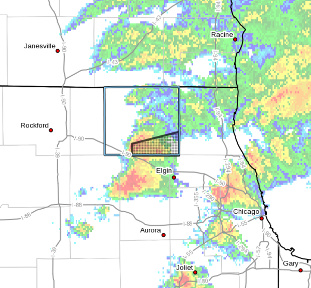
There are new tornado warnings for Cook, Kane and McHenry counties.
For Cook County, a severe thunderstorm capable of producing a tornado was located over Burr Ridge at 6:10 p.m., moving east at 30 mph.
That warning is in effect until 6:30 p.m.
That warning was extended until 7 p.m. after a large and extremely dangerous tornado was located over Summit. That storm was quickly moving towards Bridgeview, Oak Lawn, and Burbank, including Seat Geek stadium.
In McHenry County, a severe thunderstorm capable of producing a tornado was located over Huntley at 6:13 p.m., moving east at 35 mph.
That warning is expected to expire at 6:45 p.m.
In Kane County, a severe thunderstorm capable of producing a tornado was located near Campton Hills, moving east at 30 mph.
That warning is effective until 6:45 p.m.
Yet another warning was issued for northwestern DuPage and Cook counties until 7 p.m.
These dangerous storms will be near Hoffman Estates, Bartlett, Wayne, and Dupage Airport, then West Chicago, Streamwood, Carol Stream, Hanover Park, Glendale Heights, and Bloomingdale from 6:30 to 7 p.m.
Metra trains stopped due to tornado warnings
Metra said its outbound and inbound trains on the BNSF line, which runs through the western suburbs, have been stopped due to the tornado warnings. One train is stopped outside of Aurora due to mechanical problems.
Image of the storm in western suburb
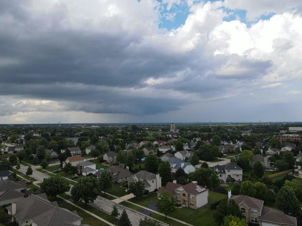
Sean Tanton took this image from his drone of ominous clouds over Naperville.
He shot this in Plainfield and looked toward Naperville.
Earlier, this storm caused a tornado warning near Oswego, but it weakened a bit as it moved west.
Timing for storms tonight
Multiple intense storms began to pop across Chicagoland around 6 p.m.
A tornado warning was issued near Oswego, but that has since expired.
Several storms popped around O'Hare to the northwest and also in the south suburbs.
The timing:
6 p.m.: Scattered, widespread storms across the suburbs
7 p.m.: Storms in Chicago
7:30 p.m.: Storms in Northwest Indiana
8 p.m.-9 p.m.: Continued storms linger in south suburbs and NW Indiana.
Alert: Tornado warning
The National Weather Service has issued a tornado warning for Kane, Kendall, DuPage, and Will counties until 6 p.m.
That warning expired just before 6 p.m., and that system is not expected to fire any tornadic activity, CBS 2 chief meteorologist Albert Ramon said.
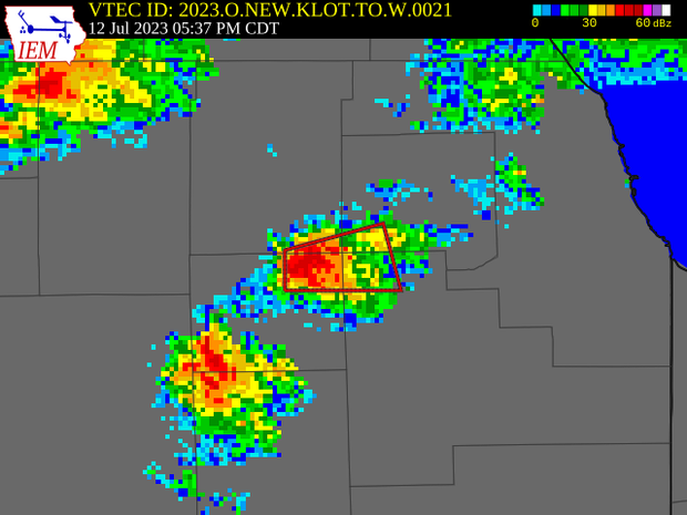
The weather service said a severe thunderstorm at 5:38 p.m. near Oswego could produce a tornado. The storm is moving east at 25 miles per hour.
The atmosphere has been heating up all afternoon, and it doesn't take much for these storms to spin into tornadoes, CBS 2 meteorologist Mary Kay Kleist said.
The storm was quickly moving into Plainfield and Naperville at 5:45 p.m.
Other locations in the path of this tornadic thunderstorm include
Bolingbrook and Romeoville.
Mobile Weather Lab checks the roads in Rolling Meadows
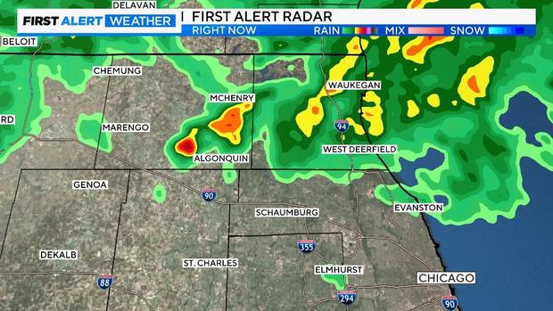
Storms fire up in McHenry County
Shortly before 5 p.m., several cells of strong rain, with some lightning, began to fire across McHenry County and were heading into Lake County.
Heavy rains, flooding stresses Flossmoor's century-old infrastructure
FLOSSMOOR, Ill. (CBS) – Flossmoor is no stranger to heavy rain, especially this summer.
In a town where the infrastructure is more than 100 years old, local leaders are working to prevent a challenging situation from becoming worse.
Crews cleared basements on Wednesday when CBS 2's Marissa Perlman was there.
The Flossmoor Village Board members watched the rain fall in the downtown area on Wednesday. As the clouds rolled in, so did the problems.
Why is Chicago area river water reversed into Lake Michigan?
CHICAGO (CBS) -- On rare occasions of heavy rainfall, the Metropolitan Water Reclamation District officials will reverse the flow of river water into Lake Michigan.
It has occurred 50 times since 1985, most recently on July 2, when some areas of Chicago got eight inches of rain.
The most significant "dry spell" was five years in the mid-1990s.
It only happens when Chicago area waterway levels become higher than Lake Michigan.
Flooding reported in Chicago streets, basements
Right now, here is a look at Chicago homes that have reported basement flooding or water in the street on Wednesday.
This data comes from 311 calls made to the city to report complaints.
The West Side has been hit hard.

