"Bomb cyclone" blasting parts of Midwest
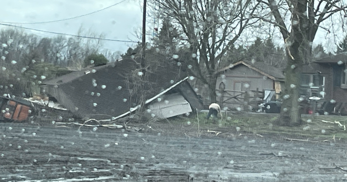
A massive late-winter storm described by meteorologists as a "bomb cyclone" barreled into the Midwest on Thursday, bringing whiteout conditions to western Nebraska and dumping heavy rain that prompted evacuations in communities farther east. In Kentucky, a tornado touched down, leaving some damage and one person injured, officials said.
South Dakota's governor closed all state offices Thursday as blizzard conditions moved in, while wind, blowing snow and snow-packed roadways made travel treacherous in western Nebraska. Heavy rain caused flooding in eastern parts of both states, as well as in Iowa.
The storm hit Colorado on Wednesday, causing widespread power outages, forced the cancellation of hundreds of flights and wreaked havoc on roadways as drivers became overwhelmed by blinding snow. A wind gust clocked in at 97 mph in Colorado Springs.
The storm also contributed to the death of Corporal Daniel Groves, a Colorado State Patrol officer who was hit and killed by a car as he helped another driver who had slid off Interstate 76 near Denver. "It is a tragic reminder that people's lives are at stake," said Shoshana Lew, head of the Colorado Department of Transportation. "The best place to be is at home and off the roads."
Follow winter storm updates below
Storm drops record rainfall in Midwest
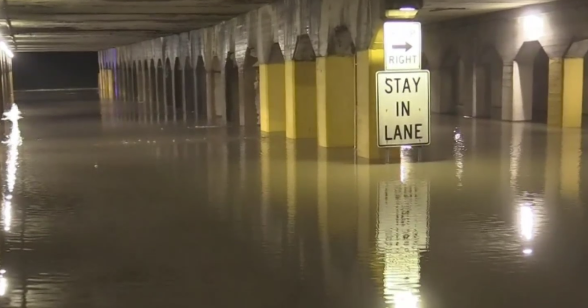
The storm has produced record rainfall in parts of the Midwest, with flooding happening in several states. The National Weather Service said several cities in eastern South Dakota and northwestern Iowa set rainfall records for the date Wednesday.
The rain caused flooding in those states, forcing the 200 residents of Hornick, Iowa, to evacuate. Weather service meteorologist Peter Rogers said flooding was likely to persist into the weekend.
Lennox, South Dakota, Mayor Tracy West said there was a lot of water around and "it's got to find a way to get out of here."
Nebraska handling flooding and howling snowstorm
Flooding forced evacuations in several eastern Nebraska communities as western Nebraska residents struggled with blizzardlike conditions. Emergency crews responded after a vehicle was swept off a road in Norfolk, Nebraska, and rising water along the Elkhorn River prompted evacuations in the city of 24,000 people.
The missing individual had not been found by midday Thursday. Authorities said a hydroelectric power dam failed on the Niobrara River in northern Nebraska, damaging a highway. No one was hurt.
In the Columbus area, the water rose quickly early Thursday. Audra Moore, a meteorologist at CBS Omaha affiliate KMTV, posted pictures to Twitter of floodwaters nearly covering vehicles and structures.
Officials said protective levees were topped or beached Wednesday in southwest Sarpy County and north of Pierce. Evacuations have occurred in Belgrade, Burwell, Cedar Rapids, Dannebrog, Harrington, Pierce, Randolph, St. Paul and Verdigre.
The National Weather Service said Loup River floodwaters posed a threat to Genoa, where evacuations have occurred.
Wind gusts approaching 90 mph were reported in the Nebraska Panhandle. The wind made travel treacherous.
Blizzard warnings remain in effect through 6 p.m. The Nebraska Transportation Department reported that Interstate 80 remained closed west of Kearney, and several highways were closed in the Panhandle and northeast Nebraska, including sections of U.S. Highway 20.
Worker dies trying to restore power in Texas Panhandle
A utility worker in the Texas Panhandle was killed while working to restore power amid powerful winds pushed in by the storm system. Amarillo-based Xcel Energy said the man died Wednesday evening while working in Hereford, near the New Mexico border.
Wind gusts in the area exceeded 80 mph. The utility said 121,000 customers in Texas and New Mexico were without power Wednesday, but that number had dropped significantly by Thursday morning.
Tornado touches down in Kentucky
A tornado blew past a National Weather Service office in Kentucky, officials said. The weather service's office in Paducah tweeted, "TORNADO JUST MISSED OUR OFFICE IN WEST PADUCAH. TAKE SHELTER NOW IF YOU'RE IN PADUCAH!!!!"
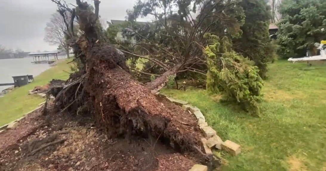
The twister left a path in western Kentucky from Lovelaceville through the West Paducah area, according to Keith Todd, a spokesman for the Kentucky Transportation Cabinet. He said the public was being asked to avoid the area while utility crews, area fire departments, and rescue squads worked to clear utility lines, downed trees and other debris.
Forecasters said numerous severe storms were possible beginning Thursday afternoon in the Tennessee Valley region and as far south as the northern Birmingham area. Video of the Kentucky tornado was posted on social media.
Jared Borum filmed the forming cyclone as it moved across a field of trees in Paducah. Borum and a room full of others watched the funnel grow and whip across the field.
"It's amazing. See the debris? You can see it hitting the trees," Borum said on his recording.
People could be heard saying, "You can see the tornado right here," ''Oh my God," "What in tarnation" and "It's a legit tornado." Officials said schools were closing early in north Alabama because of the severe weather possibility.
Forecasters said winds up to 60 mph were possible along with isolated tornadoes and hail.
Hurricane-force winds hit Denver
The storm hit Denver with rare intensity, CBS News correspondent Janet Shamlian reports. A car was smashed by a large tree as hurricane-force winds hit the area.
A whiteout on Colorado roads and interstates left traffic at a standstill for hours. On Interstate 76, the blizzard whirled around cars.
Winds pushed 18-wheelers around like toys. "Dude, that semi just slid into that other semi," a man said on a video provided to CBS News.
More than 125 crashes happened Wednesday in Denver alone. Officials shut down major interstates for driver safety.
Semi, freight-train cars no match for winds
The same system swept through Texas with winds topping 80 mph, flipping a semitruck on a highway and sending a tree through homes in Dallas, CBS News correspondent Janet Shamlian reports. In New Mexico, high winds blew freight cars off their tracks.
What is a bomb cyclone?
The strength of a storm is measured by its central pressure, Lonnie Quinn, chief weathercaster for CBS New York station WCBS-TV, explained on "CBS This Morning." The lower that number, the stronger the storm.
This storm hit a minimum central pressure of 968 millibars. By comparison, Hurricane Florence last year made landfall at 958 millibars.
This is basically a snowy hurricane, but it's a "bomb cyclone" because it got as strong as it did in just 24 hours.
One reason for the storm's strength is dry desert air has clashed with moist air from the Gulf of Mexico. Another reason is the storm's formation.
Typically, storms will have a center of circulation at the ground and another high in the sky. The closer those two get to each other, the stronger a storm becomes.
With this storm, the two centers are basically on top of each other. That creates a tunnel for air to rise.
The faster that air rises, the stronger the storm becomes. As that air rises, it pulls in air from surrounding areas, creating in this case record-setting wind gusts.


