Severe storm threat over in Southeast Michigan, but flooded areas persist due to heavy rainfall

(CBS DETROIT) - The severe storm threat is over across lower Michigan, but flooded areas remain after we experienced heavy rainfall and strong storms overnight.
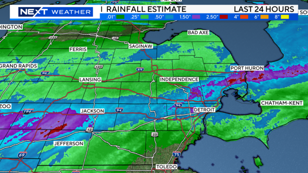
In the past 24 hours, locations in Washtenaw, Livingston, Wayne, Macomb, and Oakland counties picked up about 1 to 2 inches of rainwater. That is adding to the additional 1"+ from Sunday night's heavy rainfall. The Flood Watches for these counties have expired.
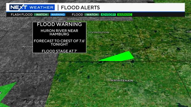
A flood warning remains for the Huron River near Hamburg. The flood stage is 7', and the river is expected to crest tonight after midnight at 7.6'.
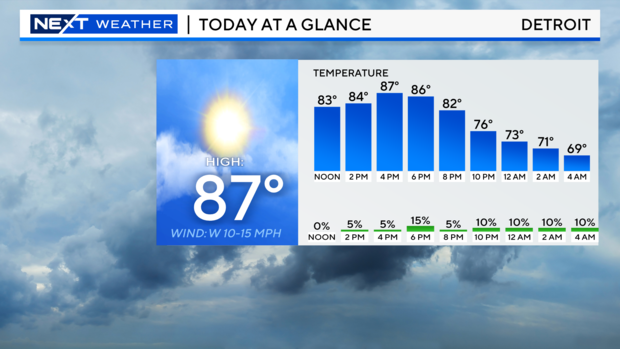
Remember to never drive through flooded waters. A few more sub-severe rain showers/storms are in the forecast today as a slow moving cold front drop through Southeast Michigan. Not everyone will experience the rain activity.
It will be breezy at times Tuesday with gusts near 20 mph. Highs today will top out in the middle to upper 80s. Lows tonight will be in the 60s.
Stay with your NEXT Weather team on-air and streaming live for updates.