NEXT Weather Forecast Oct. 3

(CBS DETROIT) - Beautiful weather to start the week before a big temperature cool-down arrives this weekend.
Temperatures early Tuesday morning felt more like fall, in the 50s and lower 60s. However, the cool morning air will not last much longer as afternoon high temperatures are expected to climb well above average for this time of year. Later in the day, high temperatures will jump into the lower and middle 80s. The forecast high temperature in Detroit on Tuesday is 84 degrees. Normally, in Detroit on Oct. 3, we should be at 68 degrees. Even though we have warm above-normal temperatures on tap for, we are not expecting to break the high-temperature record, which stands at 89 degrees, set back in 1953, for reference records began being recorded in 1874.
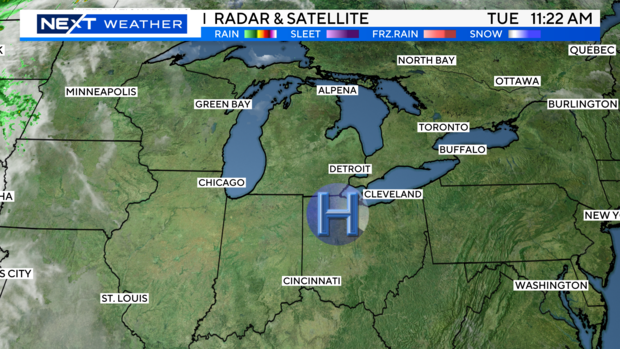
If you work outdoors, plan on taking the kids to the playground, or just plan on going for a long walk -- whatever you may be doing outdoors -- be sure to drink plenty of water and wear sunscreen since our daytime weather is feeling like Summer. Tuesday's high-pressure system is keeping the Great Lakes region dry and cloud-free, and since high pressure circulates clockwise, we have a southerly wind flow today, with winds sustained around 5 to 10 mph.
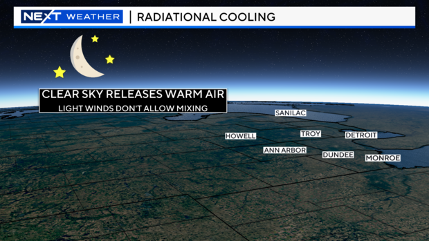
During the day, you'll need the summer attire, but at night it's going to get cool and crisp. Perhaps a nice night for opening up the windows and letting some fresh air in the house. Clear skies tonight will drop low temperatures to near 60 degrees. For Detroit, the forecast is a low of 61 degrees, with surrounding areas dropping into the upper 50s. Since we'll have a clear sky Tuesday night and a light wind, a weather phenomenon called radiational cooling will take place. (See pictures below). Let's start by discussing radiational cooling. During the day, the sun radiates and heats up the earth's surface. Well, at night, if there's cloud cover, the clouds act like a blanket trapping the heat from the day.
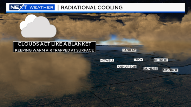
If there is a clear sky, like what we will experience here tonight, the heat we receive during the day will escape freely back into the atmosphere. Plus, there's a light wind, so no mixing can occur Tuesday night. When I reference mixing, I mean when the winds help drag the warmer air aloft to the cooler air at the surface. Since we have a clear sky and a light wind tonight, temperatures will be relatively cool overnight and throughout the early morning hours on Wednesday.
However, Wednesday morning's chill will be short-lived as temperatures rebound back in the middle 80s for highs. Almost a repeat forecast of today, but Wednesday's clouds will increase during the second part of the day.
A weather disturbance (cold front) will swing through the area starting Thursday afternoon. That will provide numerous rain showers throughout the afternoon, evening, and the overnight period. The rain gear will be needed for the end of the work week. Behind this weather system comes cooler temperatures. Highs for the weekend will only be in the lower to middle 50s. That's dropping well below average for this time of season.
Along with the cooler air this weekend, a few showers may pop up on Saturday. If you are going to a cider mill or pumpkin patch or want to decorate your house for Halloween, keep your outdoor plans, as washout weather is not expected this weekend.
Have a wonderful day, and stick with your NEXT Weather team for updates.


