Frost advisories issued for lower Michigan, but not Detroit
(CBS DETROIT) - It's that time of year when our temperatures get cooler, and we have to bundle up more often than not.
When it gets cold enough, frost and freeze alerts get issued during the growing season, which is from May 1st to October 20th in Michigan, but can be extended if necessary or shortened if we get a hard freeze.
A frost advisory is issued by the National Weather Service when temperatures get cooler than 37 degrees, winds and sky conditions are favorable for frost development during the growing season here in Detroit.
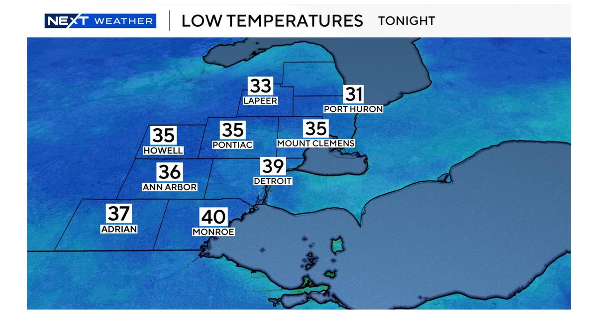
Overnight low temperatures dropped into the 40s and lower 50s in the Detroit Metro area Tuesday night into Wednesday morning, not creating a concern for frost at the moment in southeast Michigan.
However, areas in northern lower Michigan are experiencing frigid morning lows, with temperatures bottoming out in the middle 30s, creating that concern for frost development.
Accounting for this overnight/morning chill in northern lower Michigan, the National Weather Service has issued a Frost Advisory for 9 counties in northern lower Michigan. Those counties are Otsego, Montmorency, Kalkaska, Crawford, Oscoda, Wexford, Missaukee, Roscommon, and Ogemaw. Those frost advisories are set to expire later this morning at 10 AM EDT.
Frost advisories usually get issued when temperatures drop between 33 degrees and 37 degrees. When temperatures drop to 32 degrees or below, that's when locations will experience a freeze.
Residents across this area are urged to take all the necessary precautions to protect any outdoor and sensitive plants and vegetation, including bringing them inside or covering them with blankets/burlap sacks/tarps if needed. This will at least help retain the heat near the plants.
Now, for most of us being located in southeast Michigan, when will we get our first frost?! Below are the National Weather Service White Lake (Detroit) stats.
In 2022, the first frost advisory was issued on September 28 in Detroit, and the first freeze was issued on November 13. So, we have already passed that for this year.
The later fall frost extends allergy season. According to ClimateCentral.org, this summer's record-breaking heat has led to a higher count of ragweed pollen lasting into the early fall. From ClimateCentral.org, "Our warming climate results in more free-free days each year --- giving plants more time to grow and release allergy-inducing pollen earlier in spring and later into fall."
Below is the allergy report (October 12 - 14):
My forecast for the NEXT 7-days does not account for this in Detroit as lows are only going to settle in the 40s for the next week.
Even though overnight lows will be near normal in the middle 40s, high temperatures are going to remain below average. Highs today will only climb into the lower 60s, where we should be at 64 degrees for today October 12th. Averages are from 1991 to 2020, and records began in the year 1874 to the current day.
Today, an elevated frontal boundary keeps the clouds around for southeast Michigan with a small rain shower chance for our southern zones right along the Ohio/Michigan State Line.
Tomorrow will be rainy for everyone, as an area of low pressure emerging from the west will be bringing us widespread rain starting Friday evening around 7 PM through Saturday morning 8 AM with breezy conditions (NE winds at 10 to 20 mph). Please take a look at the timeline below in the posted video.
In total, 1" to 3" of rainfall will be expected Friday through Saturday. Watch out for ponding and puddling, so be careful driving.
Beyond the weekend and into next week temperatures will stay cool with highs only reaching the lower to middle 50s. Stay warm!
For the latest NEXT weather forecast, visit here, and download the CBS Detroit News App.


