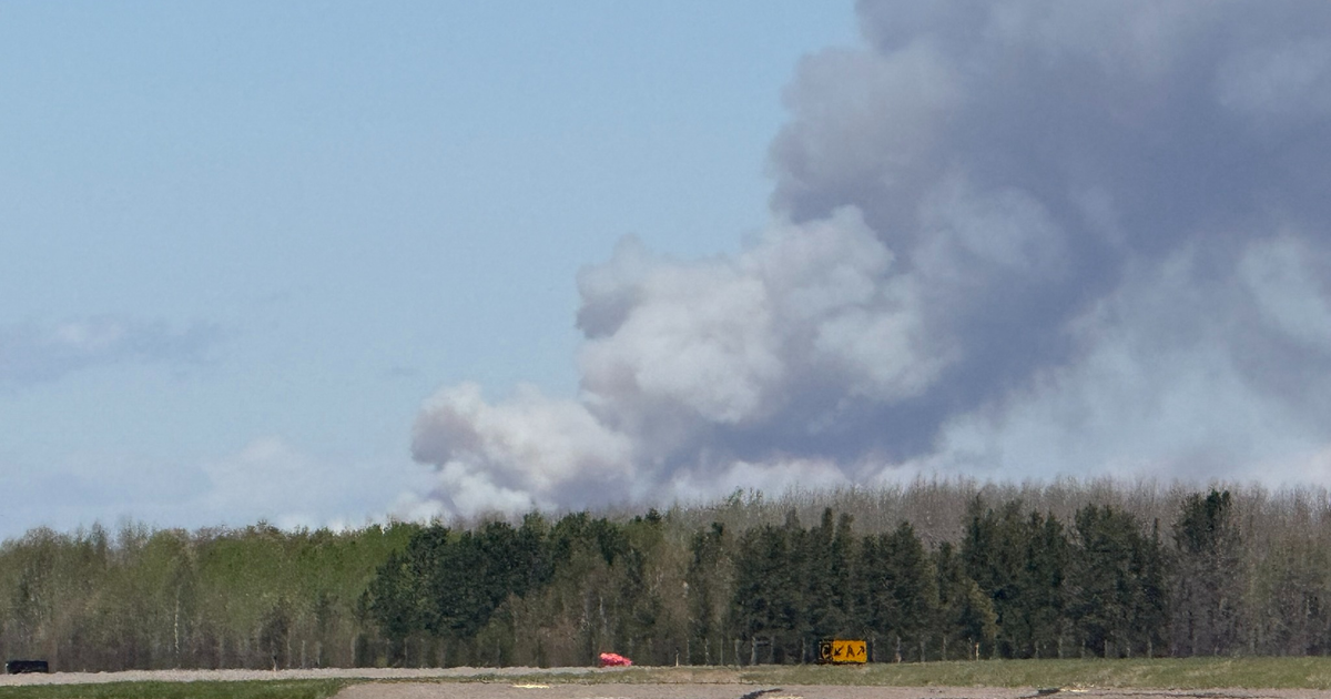
Wildfire smoke finally departs Colorado on Wednesday and is replaced with showers and thunderstorms
After almost a week of smoky skies along the Front Range, the smoke will dissipate on Wednesday as the upper level winds above Colorado shift direction.
Smoke from numerous wildfires that continue to burn in western Canada will continue to cause poor visibility during the morning hours on Wednesday. Then improving conditions are expected during the afternoon as a good chance for showers and thunderstorms develops.
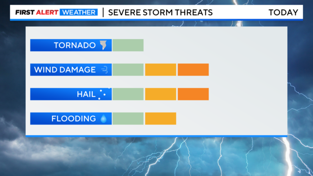
Most areas along the urban corridor will see rain and hear thunder during the second half of the day on Wednesday. Most thunderstorms will not be severe but a few could be capable of producing large hail and/or damaging wind.
For the Denver metro area, the thunderstorms may come in two waves. The initial wave in the early to mid afternoon hours and then another wave in the late evening. Regardless of the specific time, rain will be possible anytime after about 12 p.m. and before about midnight.
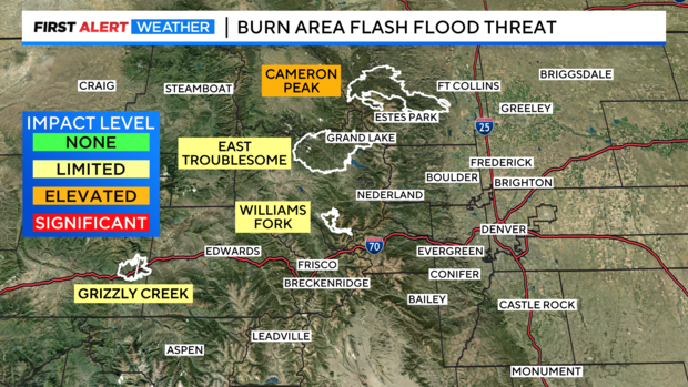
The rain could also be heavy at times so the burn scars left behind from past wildfires will have to be monitored for flash flooding in the mountains. The primary concern on Wednesday is the Cameron Peak scar of about 200,000 acres near Rocky Mountain National Park leftover from 2022.
Additional chances for showers and thunderstorms mostly in the afternoon and/or evening will continue each day through Memorial Day.