Sunday storms will bring a flash flood threat from the mountains to the plains
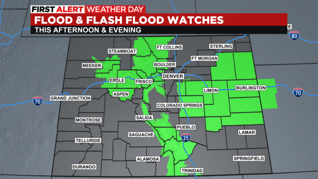
Get ready for an active Sunday afternoon and evening in Colorado when it comes to the weather. Widespread showers and thunderstorms are expected with the potential to see flash flooding. In past days the threat was confined mostly to burn scars but today the threat includes several areas from the mountains to the plains.
Storms will have the potential to drop two or more inches of rain over a relatively short period of time on Sunday. The threat is highest between 2 p.m. and 10 p.m. for most areas. The National Weather Service has placed several areas on alert. Even if your county isn't in a watch we'd still advise you to stay alert to potentially changing conditions as the storms develop.
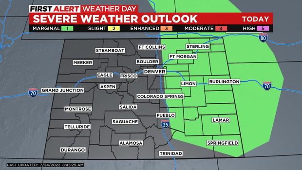
In addition to the rain a few storms could produce damaging wind gusts and hail up to one inch or larger. That threat is mostly going to be confined to the locations east of Interstate 25 on the plains.
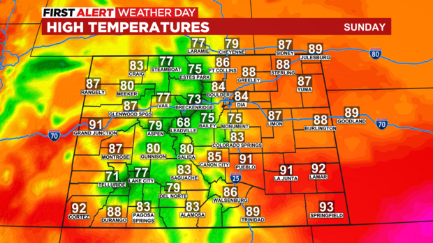
By Sunday afternoon high temperatures will be 10 to 20 degrees cooler for many areas. In Denver that means a high in the middle 80s which is a few degrees below normal for this time of year. Most of the state will be in the 70s and 80s with extensive cloud cover from the monsoon moisture.
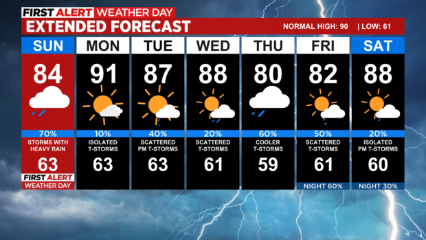
Looking ahead most of the next 5 to 7 days will feature an abundant amount of monsoon moisture that will lead to afternoon showers and storms each day. Temperatures will run near to slightly below normal for late July and that will be a nice change of pace from the recent dry and hot weather.
