Snowy Tuesday Commute, Heavy In The High Country
Monday brought warm weather to the Denver metro area with highs several degrees above average. We cracked the 50 degree mark downtown but may not do it again until the end of this week. A weak cold front moves through the city with some snow possible during the Tuesday morning commute.
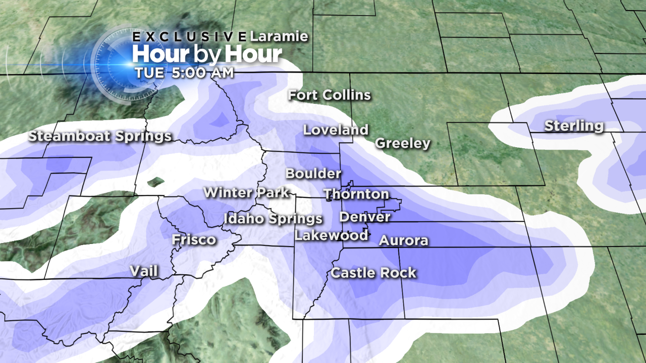
The upper level pattern becomes active for the first half of this week, and possibly again by the weekend. Denver's Tuesday morning snow is expected to be light with only minor accumulations, but the western mountains will likely receive several inches. Look for a dusting up to 1" for most of the metro area, locations on the plains could see 2–3" total.
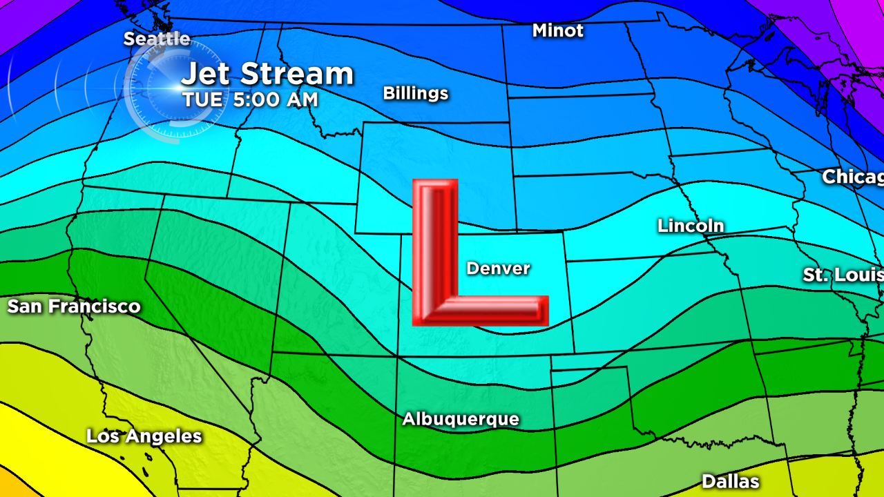
Looking at the jet stream, there's a small wave, or tough, that pushes over the state late Monday night. This wave and the surface cold front will work together to produce metro snowfall between midnight and 9 a.m. Tuesday.
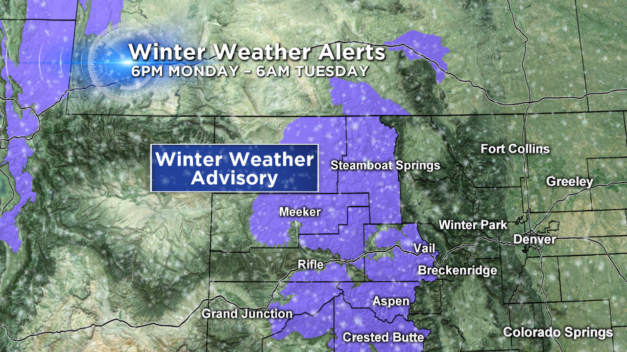
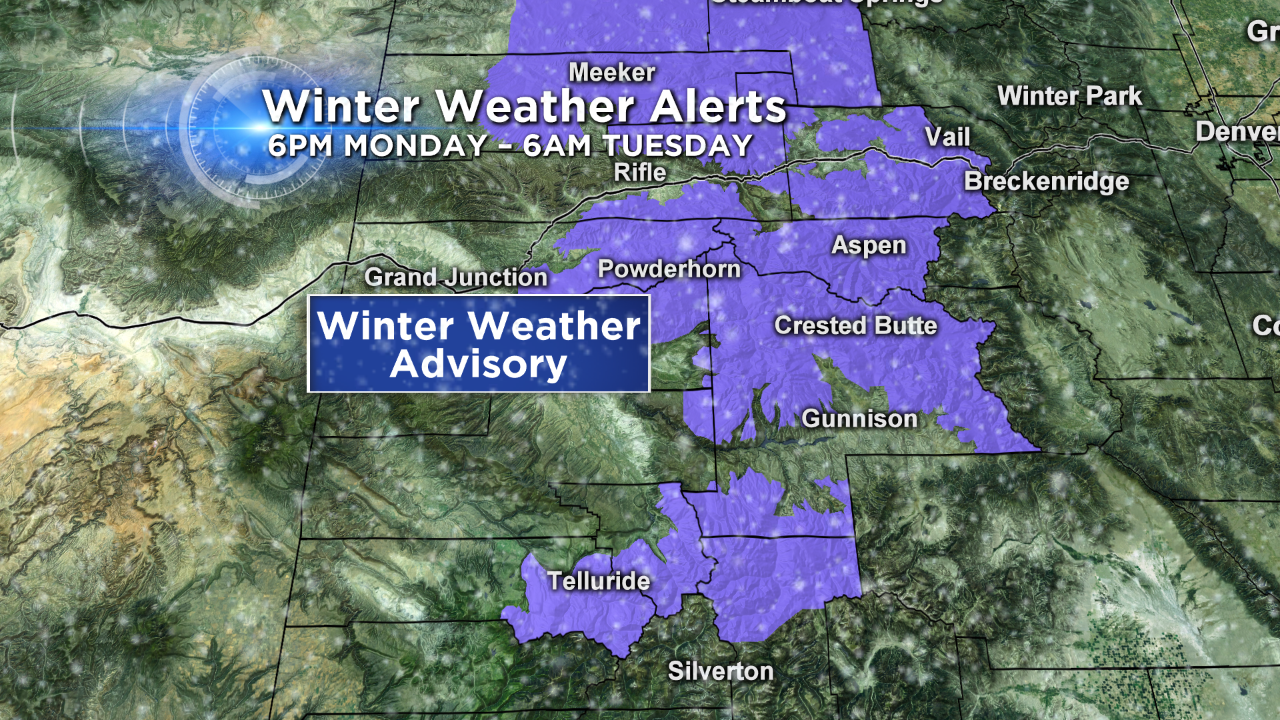
Mountain snow will be more impressive thanks to the Pacific airmass and direction of the wind flow. West facing slopes will have the best chances for heavy snow, but even the mountain valleys will end up with a few inches. The Park Range, Elk and West Elk Mountains, Gore Range, Flattops, and the northern San Juan Mountains are favored for the most snow through Tuesday. 2–5" are likely on the slopes facing away from the wind, while the western (windward) faces should pick up 5–8".
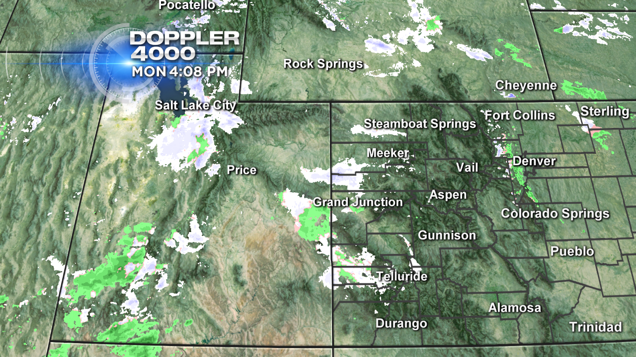
As of this post, the Salt Lake City area shows the main batch of this incoming moisture. There's already a few radar returns showing snow in far western Colorado, too.
Another potential snow-maker moves into the mountains Wednesday morning. The models still focus the most snowfall on the far western mountains, although the Front Range and Continental Divide will still end up with a few inches through Wednesday.
Justin McHeffey provides nightly reports from the Mobile Weather Lab. He travels Colorado in search of Mother Nature's most powerful and beautiful conditions. Like his Facebook page Meteorologist Justin McHeffey and follow him on Twitter @WeatherMcHeffey.
