Denver Weather: Cold And Snowy Sunday Will Set Stage For A Slick Morning Drive Monday
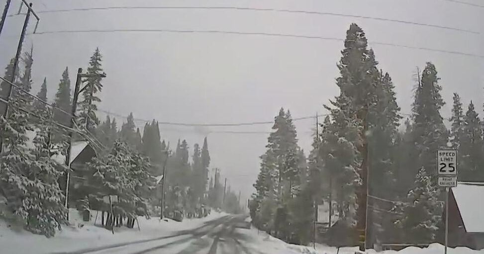
DENVER (CBS4) - It's a snow day for much of Colorado as the second part of a winter storm crosses the state. Off and on bands of light to moderate snow are expected to last into Sunday evening. After the snow bands come to an end, scattered pockets of flurries and light snow showers could persist well into the night, especially in and near the mountains.
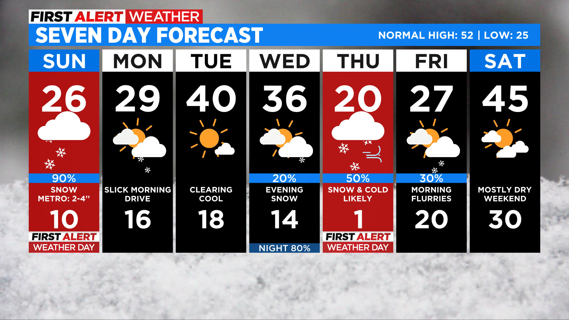
Accumulations are tough to nail down today because of a few factors. The first is the banded nature of this snowfall. If bands develop and don't move then we'll see some higher totals. But overall in the Denver metro area most places have the chance to see an additional 2 to 4 inches of snow on top of what fell last night.
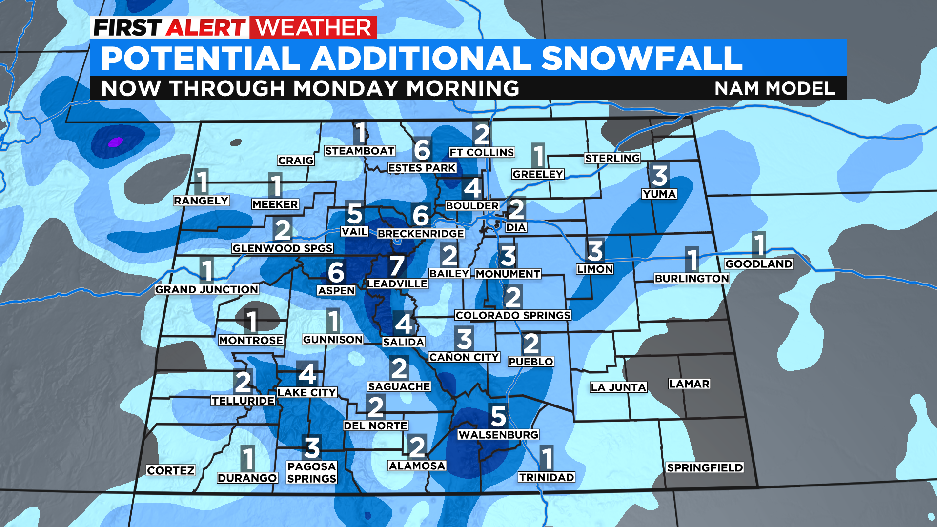
The second factor that makes predicting snow totals tough in the month of March is the longer days and higher sun angle, which can result in some melting. Even though it will be cloudy all day the sun's shortwave energy will still get through the clouds and to the ground. Dark surfaces, such as paved roadways, benefit from this energy.
The Monday morning drive could be slow and slick for many around the state. Areas of snow will linger in the mountains on Monday and we could even see some convective snow showers by Monday afternoon due to daytime heating A convective snow shower is essentially what you think of when rain showers "pop up" during the summer.
Drier and slightly warmer weather should settle into the state for Tuesday before the next storm arrives sometime on Wednesday. Right now it looks like the next storm will bring more snow in addition to another round of arctic air. A few computer models say Denver and the northeast plains could see record cold by Thursday night and Friday morning with temperatures falling to or even below zero. It's still a few days away and can change so stay tuned!
