March Ends With Above Normal Snowfall For Denver
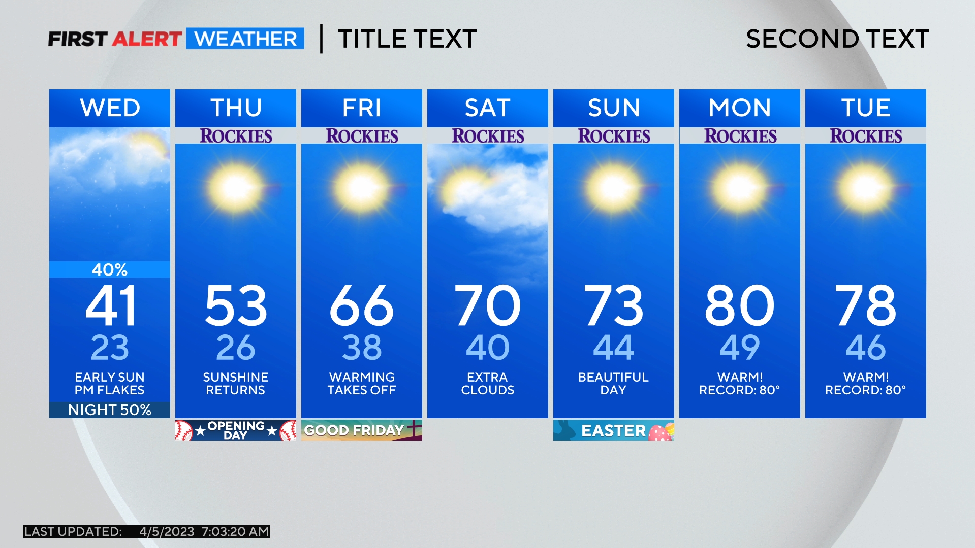
DENVER (CBS4) - Wednesday will mostly dry and quite windy. Northerly winds will gust over 30 mph in the afternoon making it feel very chilly.
The morning on Wednesday will be relatively calm before the gusty wind kicks in by early afternoon. The strongest gusts around Denver, Boulder, and Fort Collins could reach at least 40 mph. The wind will then decrease quickly after sunset which is just before 7:30 p.m. Wednesday.
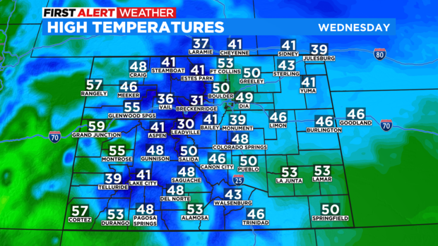
High temperatures will reach near 50 degrees along the Front Range on Wednesday but the northerly wind will make it feel cooler. Similar temperatures are expected across the Eastern Plains. Mountain towns will reach the 30s and lower 40s.
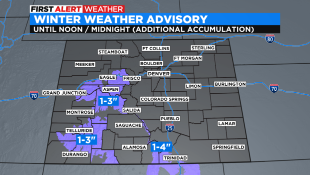
And speaking of the mountains, areas west of Vail Pass remain under a Winter Weather Advisory for 1-3 inches of additional snow through Noon on Wednesday. The southern Sange de Cristo mountains near Trinidad have a Winter Weather Advisory until midnight Wednesday night for 1-4 inches of additional snow.
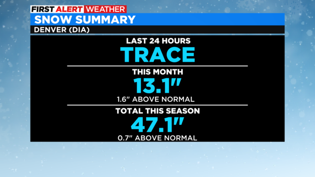
Not additional measurable moisture is expected for the metro area on Wednesday but a few sprinkles or flurries are possible. And with a dry forecast for Thursday, March should end with a total of 13.1 inches of snow in Denver. March is often the snowiest month of the season in the city with an average of 11.5 inches of snow so this month will end slightly above normal.
For the season, Denver is very close to normal which is remarkable considering how dry it was for the first 3 months of the season (October - December). The city averages 56.9 inches total for the season and so far about 83% of that snow has been received. April is the second snowiest month of the season on average with about 8.8 inches.
The next chance for any measurable snow in the Denver is likely more than a week away. A few showers are possible on Friday and again Sunday night into Monday but no measurable snow is expected at this time.
