Strong to severe storms in Colorado bringing damaging winds
It's a rare September set-up as an advancing low-pressure system will race across Colorado on Tuesday, bringing the potential for strong to severe storms, and the threat of damaging wind gusts.
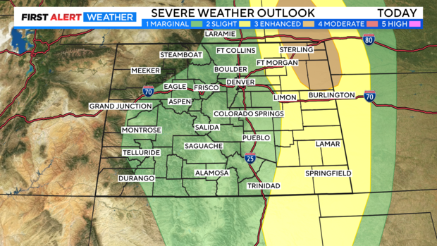
A large portion of the state is under a Level 1 "Marginal Risk" for severe weather, with Eastern Colorado under a Level 2 "Slight Risk", and the Northeastern corner of the state under a Level 3 "Enhanced Risk." The communities under that Enhanced Risk are under the greatest threat of powerful wind gusts, reaching 70+ mph at times.
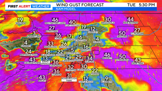
Wind gusts across the Denver metro area and Front Range can reach 40-60 mph throughout as this system moves through.
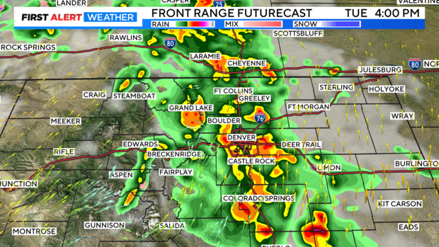
Activity began firing up in Western Colorado early Tuesday morning, and by the afternoon is expected to reach the I-25 corridor, tracking East out of the state late Tuesday night. Storms are expected to reach the Denver metro and Front Range around 2 p.m. Tuesday with impacts lasting until the dinner hour.
Winds will calm by Tuesday night, as rain and storms leave Colorado. Calmer weather returns by Wednesday.
