Denver Weather: Watch For T-Storms With Large Hail This Afternoon
DENVER (CBS4) - A few places saw thunderstorms develop early this morning, such as around Conifer and Evergreen. The storms dropped small hail between 1 and 2 am. The storms were caused by a small disturbance passing by in the atmosphere.
That scenario will likely play out again this afternoon only on a bigger scale. Areas along and east of Interstate 25 could be under the gun with strong to severe thunderstorms after 1 pm. The threat zone lies anywhere from the foothills to the eastern plains.
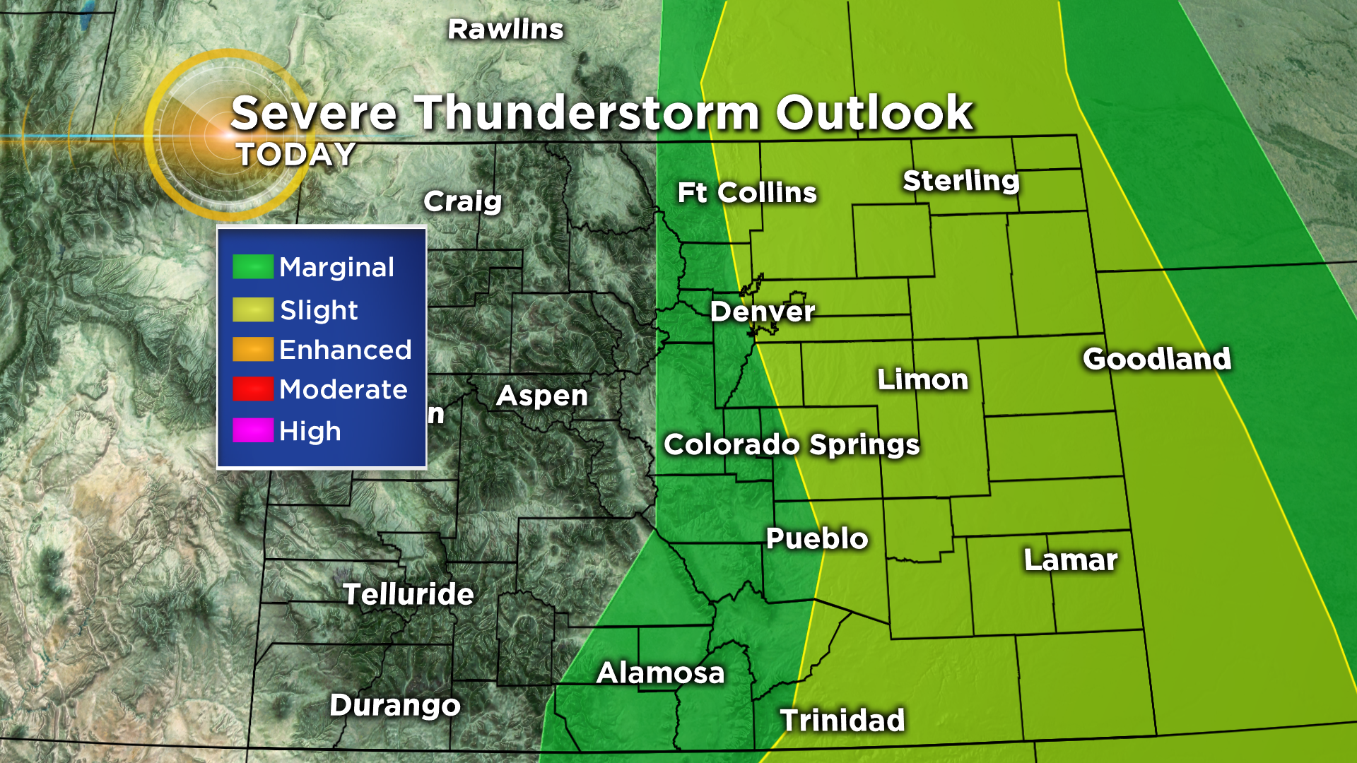
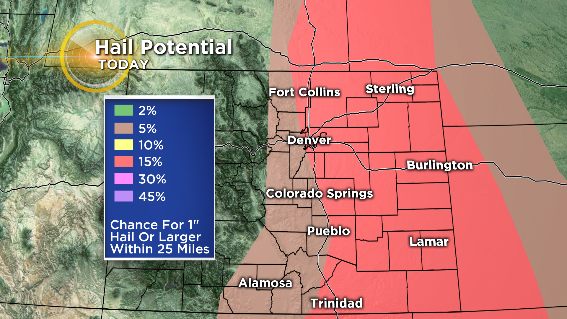
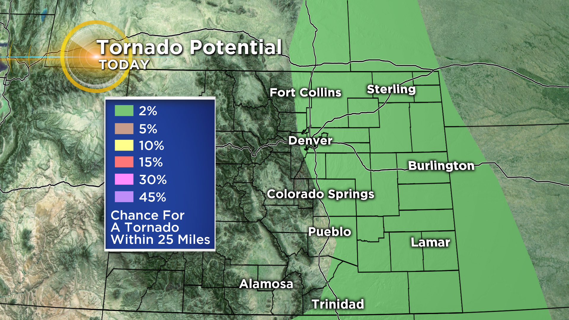
The main threat will be hail with a diameter of an inch or greater but we also have to worry about wind gusts to (or exceeding) 58 mph and the potential for an isolated tornado or two.
The timing for storms in the Denver metro area and along I-25 will be between 1-4 pm, then the threat will shift east through the evening. Some thunderstorms could fire before the noon hour over the mountains and foothills.
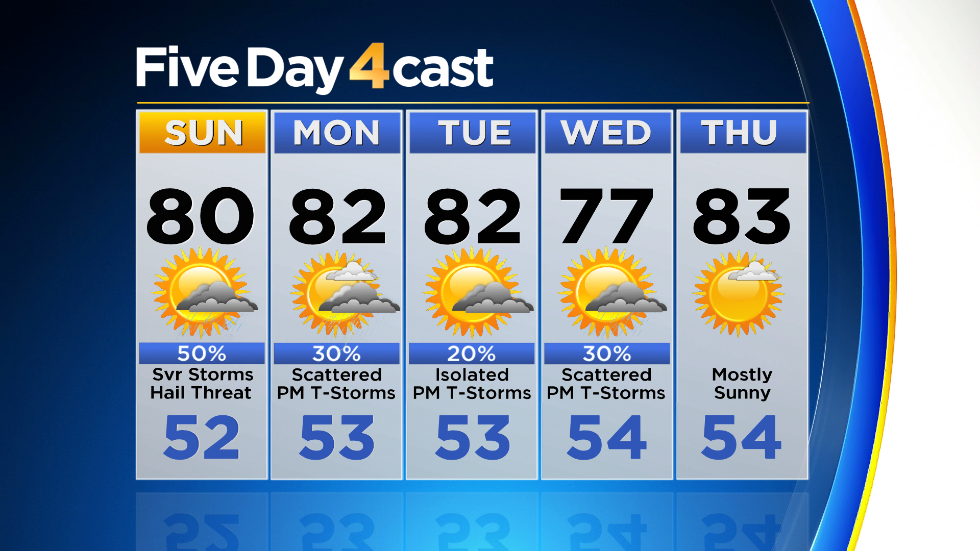
Looking ahead we don't see any significant weather systems over the next 5 days. Temperatures will be fairly close to where they should be for this time of year. There will be a daily chance for showers and thunderstorms each afternoon.
