Colorado Weather: Snow shifts onto the eastern plains on Monday as temperatures stay far below normal
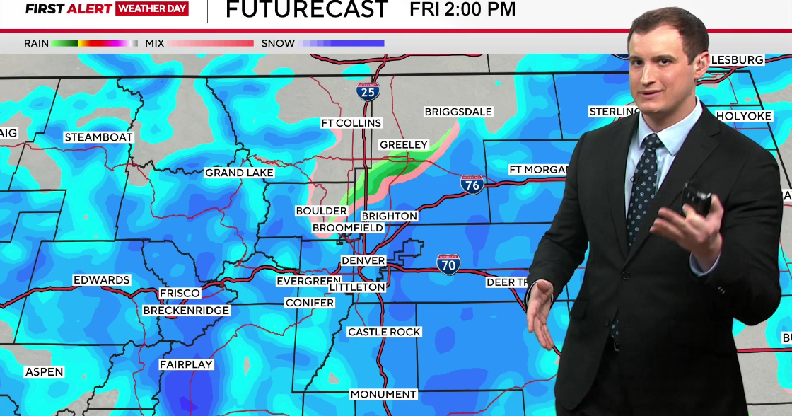
After snow during the morning commute along the Front Range Monday morning, the focus for additional snow in the afternoon will be on Colorado's Eastern Plains.
The heaviest snow along the urban corridor Monday morning was around Fort Collins, Loveland, and Greeley were heavier snow bands caused more than a half foot of snow in some areas. Severance which is about 10 miles east of Fort Collins measured nearly 9 inches of snow as of 7 a.m. on Monday.
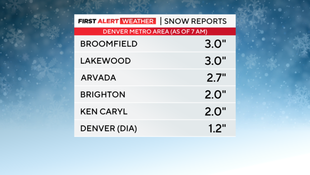
Closer to Denver, most neighbors received less than 3 inches of snow before the snow started to tapper off before 8 a.m. Any additional accumulation through the rest of the day will be very minor and most areas will be dry after 10 a.m.
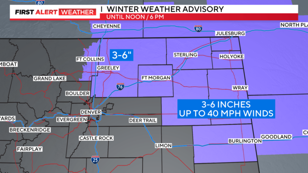
Heavier snowfall later in the day on Monday will be found across Colorado's northeast plains where a Winter Weather Advisory continues until 6 p.m. for communities like Fort Morgan, Sterling, Julesburg, Holyoake, Akron, and Wray. The combination of 3-6 inches of snow together with wind gusts up 40 mph will create very limited visibility at times. Road closures including a section of I-76 and/or I-70 are possible on the Eastern Plains on Monday.
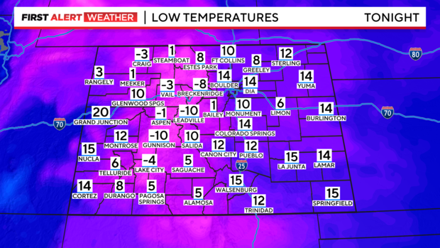
For the Denver metro area, Monday afternoon will include mostly cloudy skies, much colder than normal temperatures, and gusty northerly winds that will make it feel ever colder outside. Then a cold night is in store statewide Monday night into Tuesday morning. Some mountain communities will drop to at least -10 degrees which is far below normal for late March.
Sunshine will return to all of Colorado on Tuesday along with somewhat warmer temperatures. A bigger warmup will wait until Thursday and will not last long.
