Colorado Weather: High Fire Danger for areas of NE Colorado

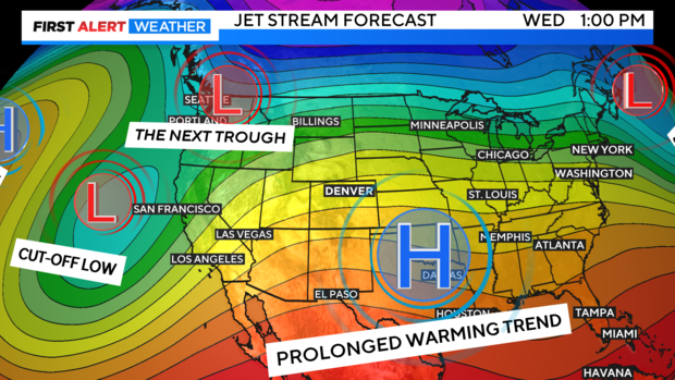
Our prolonged warming trend is locked in for the week ahead. Temperatures, wind and low humidity levels will be creating a higher fire danger for parts of eastern Colorado.
A strong high pressure ridge is sliding through the Rocky Mountain region. This warming pattern will be stretching out over a large chunk of the nation.
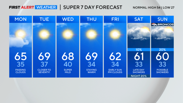
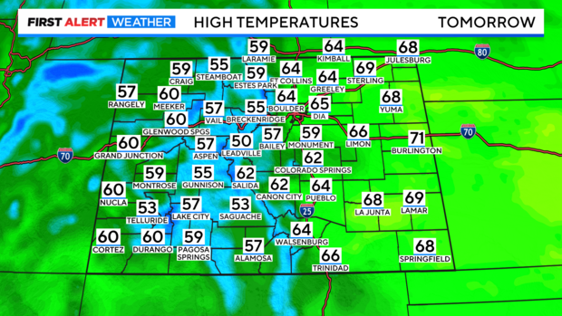
Temperatures will be zooming above normal for this time of year. Statewide we are looking at high temperatures in the 60s at lower elevations with 40s and 50s in the mountains.
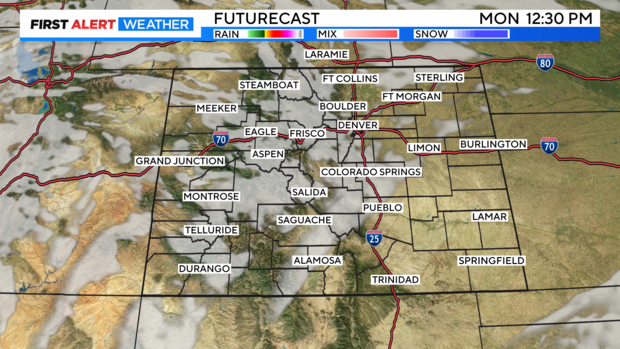
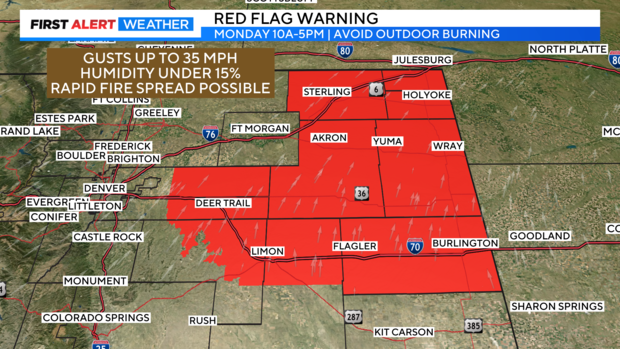
Along with the warmer temperatures there may be just a few high clouds drifting over the state on Monday. There is not enough moisture in any of these clouds to create any rain or snow. As a result, humidity levels will be extremely low. Especially, over the eastern plains where reading may be lower than 15 percent.
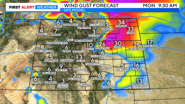
Wind gusts on the northeastern periphery of the high pressure center will be fairly strong. With gusts over northeastern Colorado picking up into the 30 to 40 mph range from time to time.
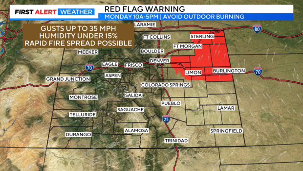
This triple mix of warmth, wind and dryness is boosting the fire danger threat just east of Denver into the eastern and northeastern plains. A Red Flag Warning for high fire danger has been posted for Monday from 10am to 5pm.
The warm temps and dry stretch will hold on thru the end of the week.